Single Image Page
Simpson’s Place Farm Map, Beckenham 1822
Simpson’s Place Farm Map, Beckenham 1822
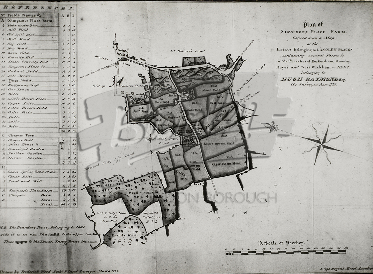
Simpson's Place Farm Map, Beckenham 1822
Map of land belonging to Hugh Raymond (surveyed 1732, drawn 1822), part of the Langley PlaceDigital download available soon
While we rollout digital download option for this site, please contact development@maxcommunications.co.uk if you would a like digital download of this image. Please use the reference bromley-7076
#1820s #Beckenham #DRAWING #Farms