Single Image Page
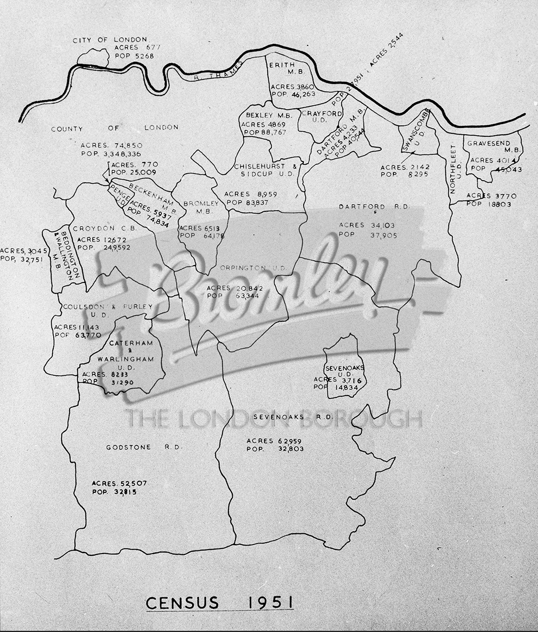
Map of urban and rural district council’s to the south east of London 1951, North West Kent 1951
Map of urban and rural district council’s to the south east of London 1951, North West Kent 1951
Map of urban and rural district council's to the south east of London 1951 , North West Kent 1951
Map of urban and rural district council's to the south east of London 1951. Shows acreage and population from 1951 census.
Buy a High Resolution Version of this Image to Print at Home for £12.00
You can use the button below to buy a high resolution version of this image to print at home.
This image is supplied for private use or study. If you wish to use the image commercially or publish it in any medium, please contact historic.collections@gll.org.
#1950s