Single Image Page
LAMBETH PARISH BOUNDARY, CLAPHAM
LAMBETH PARISH BOUNDARY, CLAPHAM
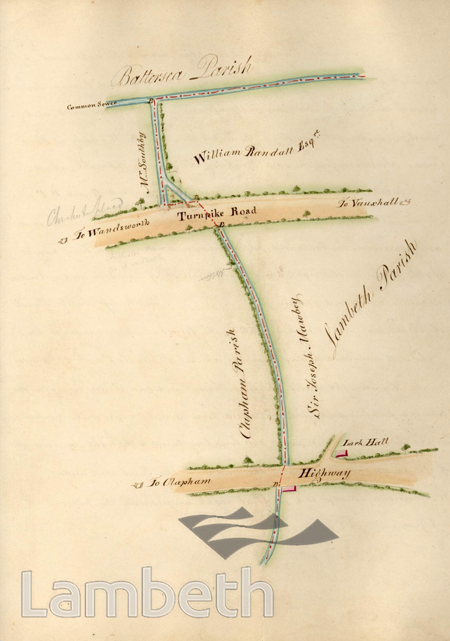
Plan showing a perambulation along the 1808 Lambeth parish boundary bordering Clapham and Battersea parishes, between Larkhall Lane (Highway) and Wandsworth Road (Turnpike Road). Places noted in the accompanying text include: Lark Hall and Sir Joseph Mawbey's land; the Brook or common sewer between William Randall Esq and Mr Southby.From 'Perambulation of the Parish of Lambeth in the County of Surrey, 1808' by Middleton and Bailey, Lambeth: '...the Rector, parish Officer and Inhabitants of Lambeth, have, from time immemorial, been in the habit of walking the Bounds of the Parish.'
Buy a High Resolution Version of this Image to Print at Home for £12.00
You can use the button below to buy a high resolution version of this image to print at home.
This image is supplied for private use or study. If you wish to publish the image in any medium, please complete and return the copyright declaration, telling us about your intended use. Please return the completed form to archives@lambeth.gov.uk.
Download commercial reproduction application form here.
| Details | |
|---|---|
| Collection: | Local History Library |
| Image type: | Pen and Ink |
| Artist: | Bailey Middleton |
| Ref: | 01619 |
| Identifier: | P6 / p61 |
| Date: | 1808 |
#-Before 1850 #CLAPHAM #Local History Library #OPEN SPACES #Pen and Ink #RIVERS AND WATERCOURSES #ROADS AND STREETS #STREET FURNITURE