Single Image Page
THE CITY AND SUBURBS OF LONDON : MAP OF THE FORTIFICATION
THE CITY AND SUBURBS OF LONDON : MAP OF THE FORTIFICATION
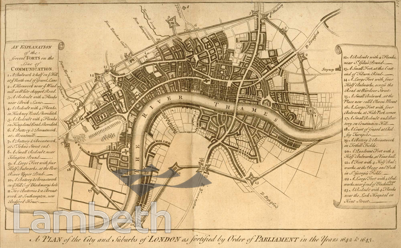
Early print showing 'A Plan of the City and Suburbs of London as Fortified by Order of Parliament in the Years 1642 & 1643'. The fortifications consisted of ramparts and ditches with forts at regular intervals and were built with large numbers of enthusiastic volunteer Londoners. At the north end of Lambeth there were three forts each with four half bulwarks, one at Vauxhall, one by the Dog and Duck in St George's Fields and one near the end of Blackman Street, the present day Newington Causeway.
Buy a High Resolution Version of this Image to Print at Home for £18.00
You can use the button below to buy a high resolution version of this image to print at home.
This image is supplied for private use or study. If you wish to publish the image in any medium, please complete and return the copyright declaration, telling us about your intended use. Please return the completed form to archives@lambeth.gov.uk.
Download commercial reproduction application form here.
| Details | |
|---|---|
| Collection: | LAD Cuttings and Ephemera |
| Image type: | Etching |
| Artist: | |
| Ref: | 01845 |
| Identifier: | Cuttings File 32 |
| Date: | c.1700 |
#-Before 1850 #ARCHITECTURE / BUILDINGS #Cuttings and Ephemera #Etching #ROADS AND STREETS #WAR AND ARMED FORCES
No location data for this post.