Single Image Page
MAPS OF LONDON POVERTY, LAMBETH (AREA-WIDE) :MAP 1
MAPS OF LONDON POVERTY, LAMBETH (AREA-WIDE) :MAP 1
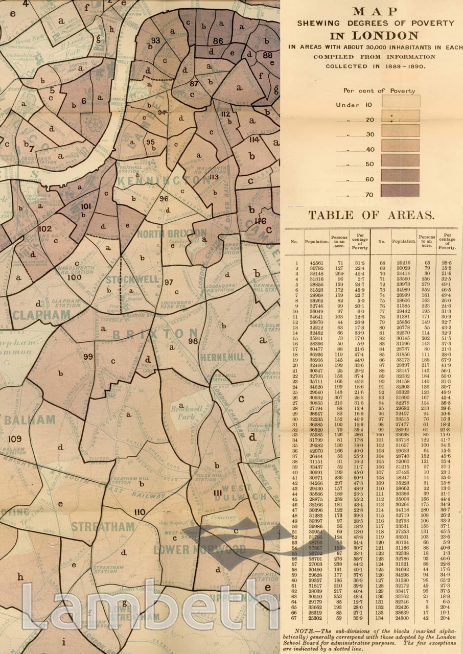
The Lambeth area from Map.1, 'London Poverty by Districts', taken from the 'Survey of Life and Labour of the People in London' by Charles Booth (1840-1916). The survey of living and working conditions in London took him and his team of researchers seventeen years to complete and was published in seventeen volumes. Map published with the appendix to Volume II of the Survey by Stanford's Geographical Establishment, 1891.
Buy a High Resolution Version of this Image to Print at Home for £12.00
You can use the button below to buy a high resolution version of this image to print at home.
This image is supplied for private use or study. If you wish to publish the image in any medium, please complete and return the copyright declaration, telling us about your intended use. Please return the completed form to archives@lambeth.gov.uk.
Download commercial reproduction application form here.
| Details | |
|---|---|
| Collection: | |
| Image type: | |
| Artist: | |
| Ref: | 01964 |
| Identifier: | 2/16 MAP1 |
| Date: | 1891 |
#1876 - 1900 #OPEN SPACES #Print #RIVERS AND WATERCOURSES #ROADS AND STREETS #WELFARE AND SOCIAL INSTITUTIONS
No location data for this post.