Single Image Page
PLAN OF NORWOOD COMMON, WEST NORWOOD
PLAN OF NORWOOD COMMON, WEST NORWOOD
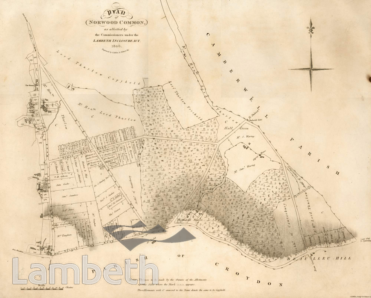
A map of the area between Knights Hill in the west and Gipsy Hill in the east showing the ownership of the area following the passing of the Enclosure Act of 1806. A considerable amount of land is shown in the ownership of Lord Thurlow, the Lord Chancellor in the late 18th century. The remaining wooded areas, part of the original Great North Wood are shown in the ownership of the Archbishop of Canterbury. Many of the plots are marked with the letter C which stands for 'Copyhold', a form of tenancy that was turned into freehold in 1926. This section of Elder Road is now Norwood High Street; and Gipsy House Road is now Chapel Road. Print of a plan engraved by G.Mills, 1806.
Buy a High Resolution Version of this Image to Print at Home for £18.00
You can use the button below to buy a high resolution version of this image to print at home.
This image is supplied for private use or study. If you wish to publish the image in any medium, please complete and return the copyright declaration, telling us about your intended use. Please return the completed form to archives@lambeth.gov.uk.
Download commercial reproduction application form here.
| Details | |
|---|---|
| Collection: | |
| Image type: | |
| Artist: | |
| Ref: | 04999 |
| Identifier: | SUB/LAM/01293 |
| Date: | 1806 |
#-Before 1850 #OPEN SPACES #Print #ROADS AND STREETS