Single Image Page
ANGELL WARD, PARISH MAP, LOUGHBOROUGH JUNCTION
ANGELL WARD, PARISH MAP, LOUGHBOROUGH JUNCTION
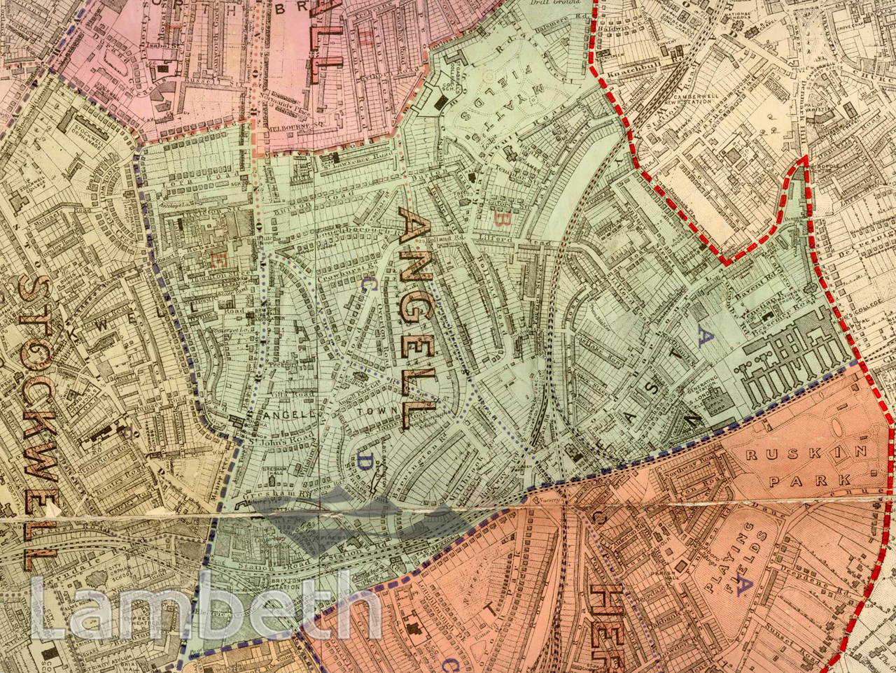
Angell Town, was developed in the 1850s around Wiltshire Road on property belonging to the Angell family, who owned the original Stiles Farm that lay on the site. With the focus as St.John's Church, and laid out as detached and semi detached villas and terraces, it was drastically altered after World War II with blocks of social housing estates spread over the ward. Myatts Fields, top centre, was part of the estate of the Huguenot philanthropist, William Minet, who donated the park and a library to the people of Camberwell and Lambeth. The railway lines from Loughborough Junction included both the South London Line into the city as well as the Crystal Palace and South London Junction Railway spur to Peckham. Extracts from the map of the Metropolitan Borough of Lambeth showing the wards, parliamentary divisions and subdivisions into poling districts, 1918.
Buy a High Resolution Version of this Image to Print at Home for £18.00
You can use the button below to buy a high resolution version of this image to print at home.
This image is supplied for private use or study. If you wish to publish the image in any medium, please complete and return the copyright declaration, telling us about your intended use. Please return the completed form to archives@lambeth.gov.uk.
Download commercial reproduction application form here.
| Details | |
|---|---|
| Collection: | |
| Image type: | |
| Artist: | |
| Ref: | 05005 |
| Identifier: | SUB/LAM/01321 |
| Date: | 1918 |
#1901 - 1925 #OPEN SPACES #Print #ROADS AND STREETS #TRANSPORT