Single Image Page
MAP OF CENTRAL BRIXTON AND BRIXTON HILL
MAP OF CENTRAL BRIXTON AND BRIXTON HILL
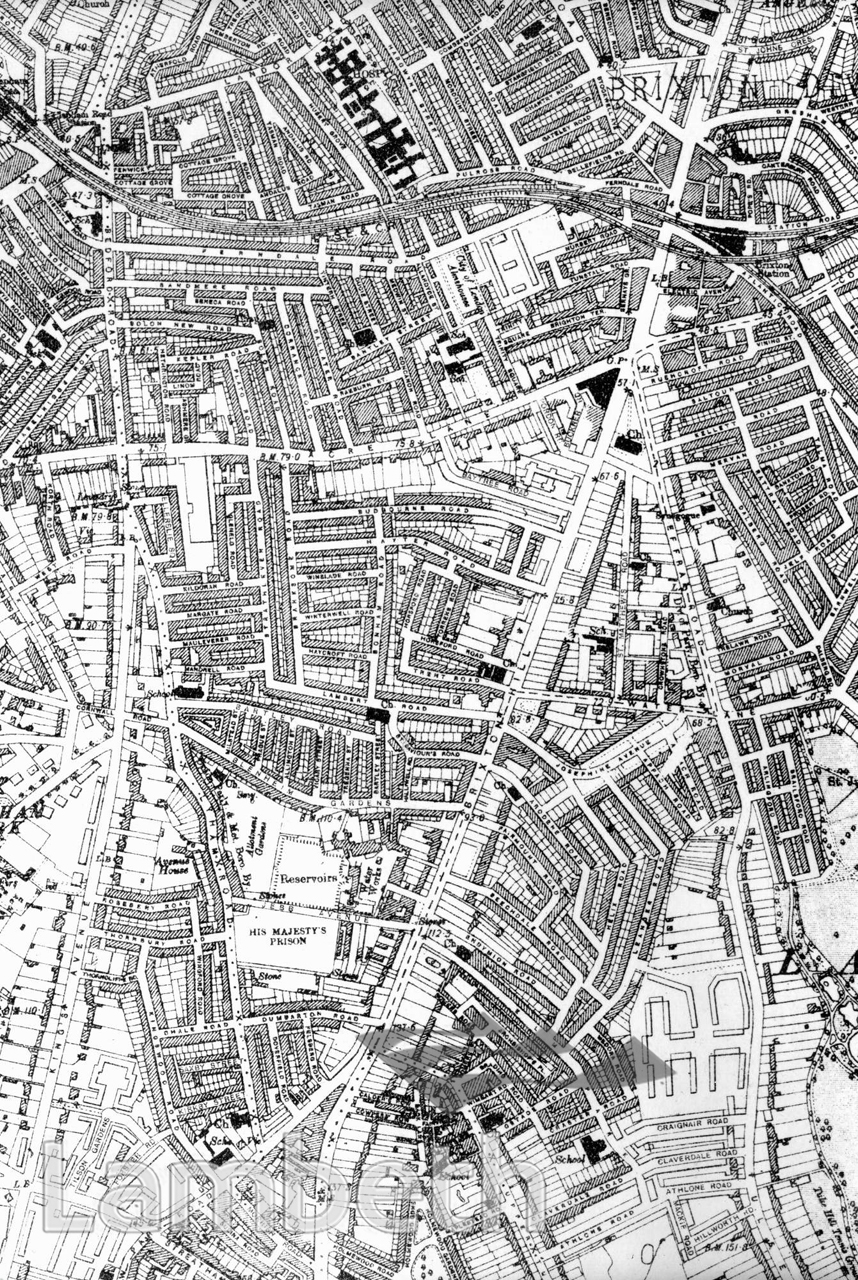
Map of the area around Brixton Hill, shown here almost fully populated, with ribbon development along most of the roads, reflecting a mixture of terraced and semi-detached housing. Housing estates were to replace many of the existing roads and terraces, particularly following the extensive bomb damage to the area during World War II. However, one of the earliest, the Tulse Hill Estate, can be seen in the bottom right corner. Brixton Prison, in the centre, built in 1820, was renovated and became the trial and remand prison for London in 1902. Ordnance Survey Map 1920, N.IX Series2.
Buy a High Resolution Version of this Image to Print at Home for £18.00
You can use the button below to buy a high resolution version of this image to print at home.
This image is supplied for private use or study. If you wish to publish the image in any medium, please complete and return the copyright declaration, telling us about your intended use. Please return the completed form to archives@lambeth.gov.uk.
Download commercial reproduction application form here.
| Details | |
|---|---|
| Collection: | |
| Image type: | |
| Artist: | |
| Ref: | 05010 |
| Identifier: | SUB/LAM/01326 |
| Date: | 1920 |
#1901 - 1925 #LAW AND ORDER #LOCAL GOVERNMENT #Print #RELIGION #ROADS AND STREETS