Single Image Page
MAP OF BRIXTON, CLAPHAM AND STREATHAM
MAP OF BRIXTON, CLAPHAM AND STREATHAM
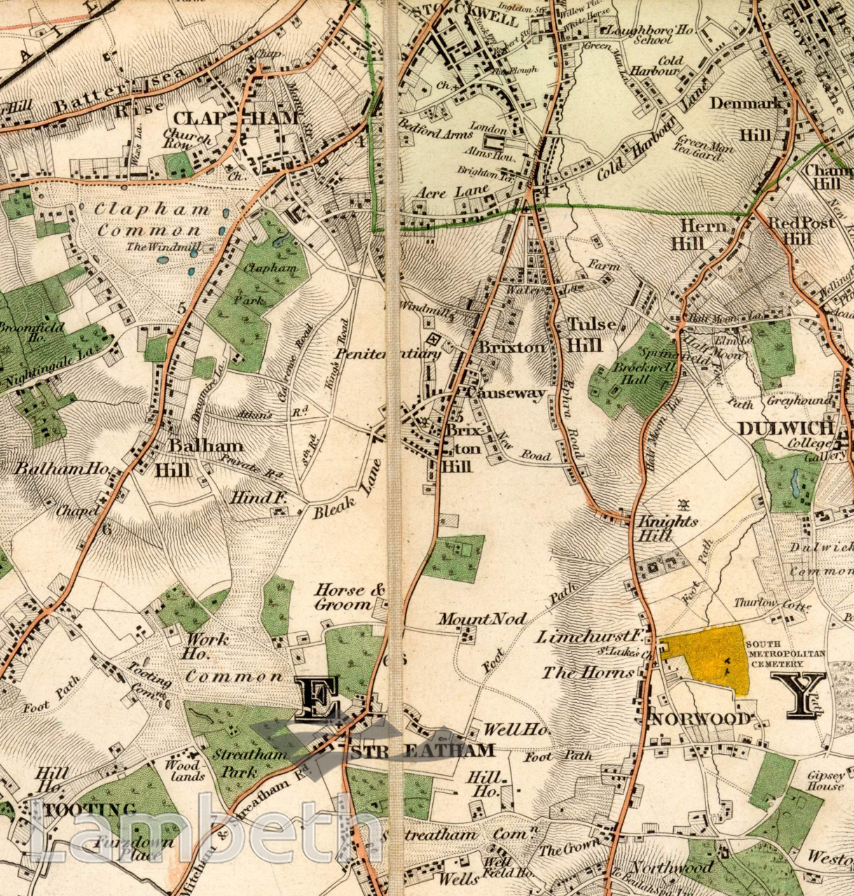
This map of the southern part of Lambeth highlights the rural aspect of the area at a time when it was made up of fields and parkland attached to the large private estates that still existed. It also demonstrates the slow development experienced by Thomas Cubitt in his Clapham Park scheme, top left, commenced in 1825. The hamlet around Brixton Causeway, seen in the centre, was developing fast due to its position next to central Brixton, as well as the penitentiary and the flourmills nearby. Ribbon development along Effra Road (now Tulse Hill), which linked Brixton and Norwood, reflected the growing demand for suburban residences for wealthy City businessmen. The spa wells on Streatham common, bottom of the picture, and Well House to its north, were to make Streatham a desirable busy suburb to live in. 'Map of London and it's Environs', published by B.R.Davies, 1840.
Buy a High Resolution Version of this Image to Print at Home for £18.00
You can use the button below to buy a high resolution version of this image to print at home.
This image is supplied for private use or study. If you wish to publish the image in any medium, please complete and return the copyright declaration, telling us about your intended use. Please return the completed form to archives@lambeth.gov.uk.
Download commercial reproduction application form here.
| Details | |
|---|---|
| Collection: | |
| Image type: | |
| Artist: | |
| Ref: | 05018 |
| Identifier: | SUB/LAM/01340 |
| Date: | 1840 |
#-Before 1850 #OPEN SPACES #Print #ROADS AND STREETS