Single Image Page
MAP OF THE THORNYCROFT ESTATE, STOCKWELL
MAP OF THE THORNYCROFT ESTATE, STOCKWELL
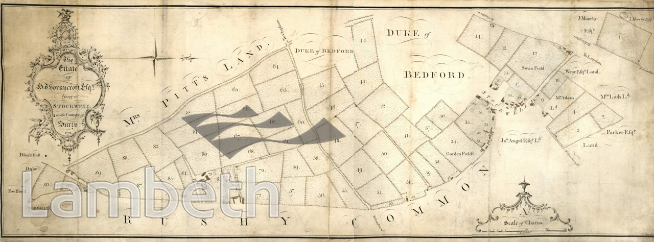
Map of the estate of Sir John Thornycroft, Lord of Stockwell Manor. With the advent of wealthy City merchants moving into areas like Stockwell and Brixton at the end of the 18th century and the beginning of the 19th, large houses and lands were being sub divided. This estate was split up and in 1802 and auctioned off to separate owners. Rushy Common, seen at the bottom was the marshy area at the point where the land begins to rise towards Brixton Hill, and is still seen as a green strip east of present day Brixton Hill. New Park Road replaced Bleak Hall Road on the left, and Acre Lane is the lane in the centre of the picture.
Buy a High Resolution Version of this Image to Print at Home for £18.00
You can use the button below to buy a high resolution version of this image to print at home.
This image is supplied for private use or study. If you wish to publish the image in any medium, please complete and return the copyright declaration, telling us about your intended use. Please return the completed form to archives@lambeth.gov.uk.
Download commercial reproduction application form here.
| Details | |
|---|---|
| Collection: | |
| Image type: | |
| Artist: | |
| Ref: | 05019 |
| Identifier: | 15/1773/MF |
| Date: | 1773 |
#-Before 1850 #OPEN SPACES #Print #ROADS AND STREETS