Single Image Page
MAP OF 19TH CENTURY PARISHES: STREATHAM PARISH
MAP OF 19TH CENTURY PARISHES: STREATHAM PARISH
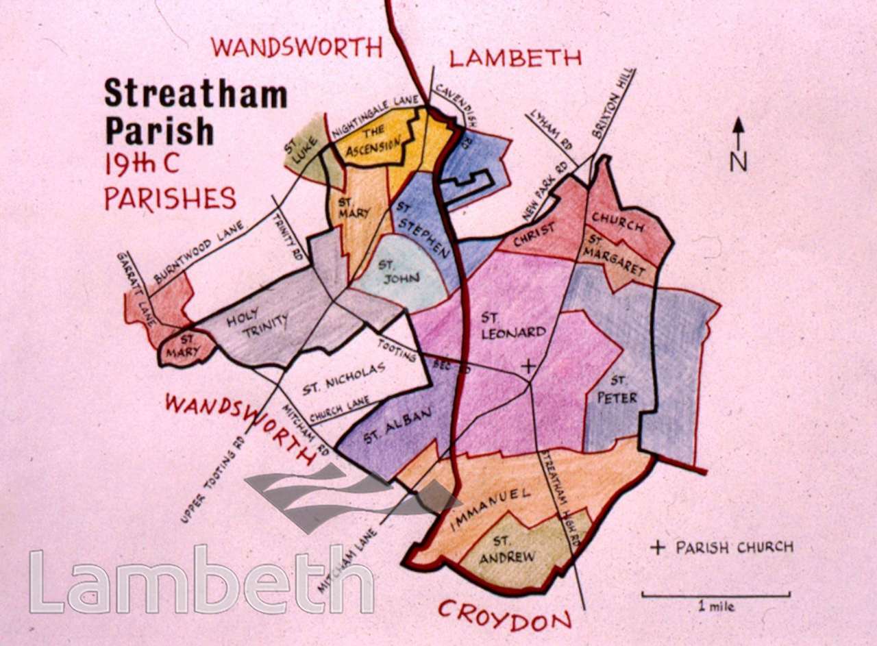
Streatham Parish, from maps of 19th century parishes. Lying on either side of the boundary between the boroughs of Wandsworth and Lambeth, Streatham was originally part of the Borough of Wandsworth. The parish church, St Leonards is marked at the junction of Streatham High Road and Mitcham Lane.
Buy a High Resolution Version of this Image to Print at Home for £18.00
You can use the button below to buy a high resolution version of this image to print at home.
This image is supplied for private use or study. If you wish to publish the image in any medium, please complete and return the copyright declaration, telling us about your intended use. Please return the completed form to archives@lambeth.gov.uk.
Download commercial reproduction application form here.
| Details | |
|---|---|
| Collection: | Gower Collection |
| Image type: | |
| Artist: | |
| Ref: | 05351 |
| Identifier: | SPd3435 |
| Date: | c.1950 |
#1901 - 1925 #Graham Gower Collection #Print #RELIGION #ROADS AND STREETS