Single Image Page
AERIAL VIEW, VAUXHALL BRIDGE
AERIAL VIEW, VAUXHALL BRIDGE
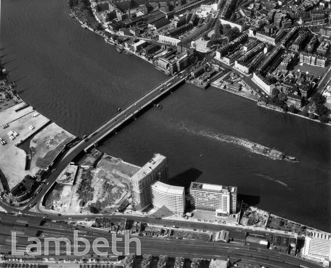
Aerial photograph of Vauxhall, the Thames, and railway line. The large sites either side of Bridgefoot (formerly Upper Kennington Lane) show surviving docks, minus the warehouses.
Buy a High Resolution Version of this Image to Print at Home for £18.00
You can use the button below to buy a high resolution version of this image to print at home.
This image is supplied for private use or study. If you wish to publish the image in any medium, please complete and return the copyright declaration, telling us about your intended use. Please return the completed form to archives@lambeth.gov.uk.
Download commercial reproduction application form here.
| Details | |
|---|---|
| Collection: | Department of Town Planning |
| Image type: | Photograph |
| Artist: | |
| Ref: | 08859 |
| Identifier: | LBL/DTP/UD2/1/12/578 |
| Date: | c.1962 |
#1951 - 1975 #BRIDGES #Department of Town Planning #Photograph #RIVERS AND WATERCOURSES #ROADS AND STREETS #TRANSPORT