Single Image Page
CENTRAL HILL SITE, UPPER NORWOOD
CENTRAL HILL SITE, UPPER NORWOOD
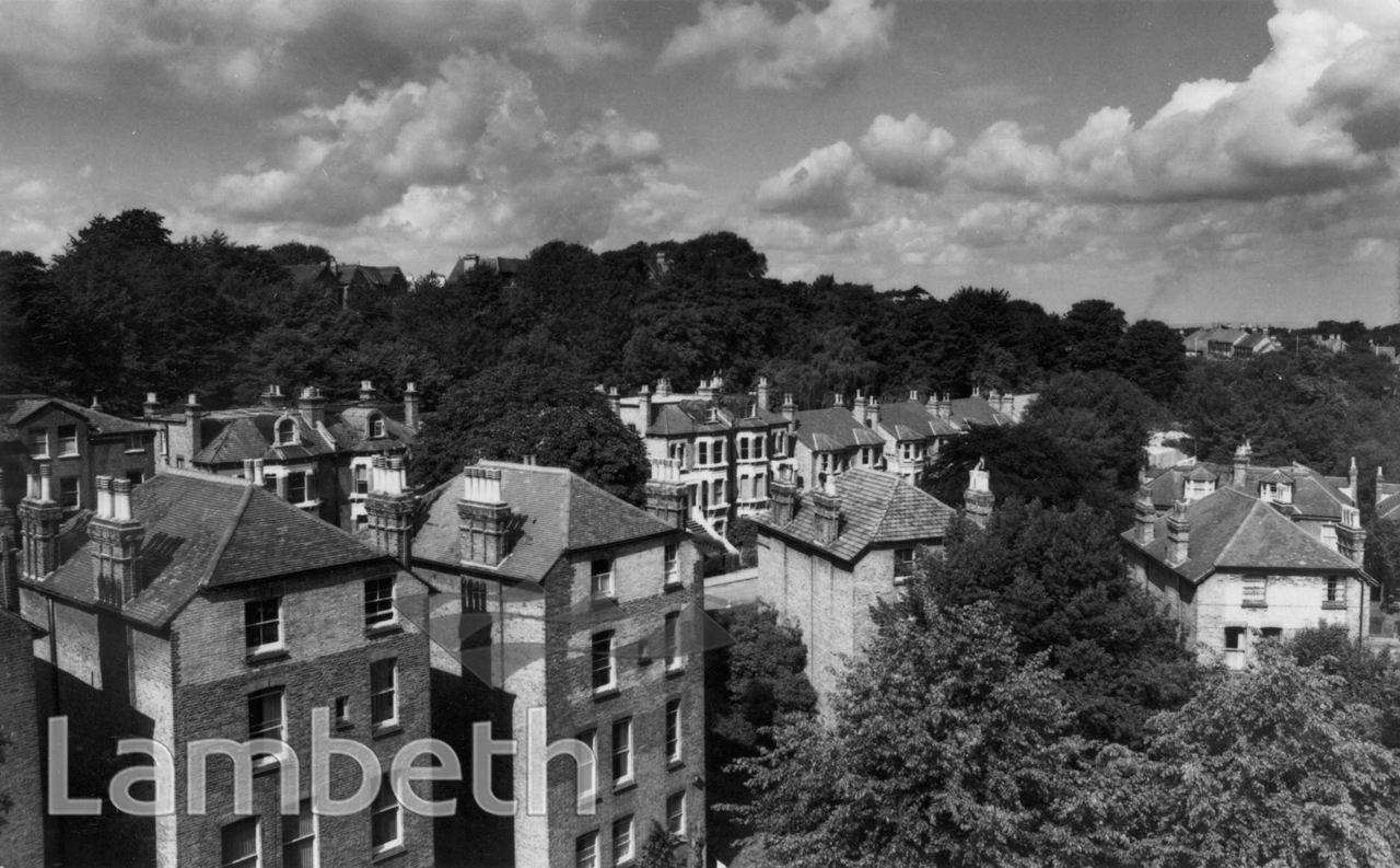
Large Victorian terraced houses in an unidentifed Upper Norwood Street - part of a set of photographs annotated 'Central Hill development site'. This area around Hawke Road, Lunham Road and Central hill was partially cleared for the Central Estate, built to provide high-density council housing in the late 1960s/ early 1970s. Photograph by Eric de Mare dated August 1966.
Buy a High Resolution Version of this Image to Print at Home for £18.00
You can use the button below to buy a high resolution version of this image to print at home.
This image is supplied for private use or study. If you wish to publish the image in any medium, please complete and return the copyright declaration, telling us about your intended use. Please return the completed form to archives@lambeth.gov.uk.
Download commercial reproduction application form here.
| Details | |
|---|---|
| Collection: | Department of Town Planning |
| Image type: | Photograph |
| Artist: | de Maré |
| Ref: | 10226 |
| Identifier: | LBL/DTP/UD/6/2/1/77 |
| Date: | 1966 |
#1951 - 1975 #Department of Town Planning #HOUSING #Photograph #UPPER NORWOOD