Single Image Page
FIELD MAP: CAMBERWELL TO HERNE HILL
FIELD MAP: CAMBERWELL TO HERNE HILL
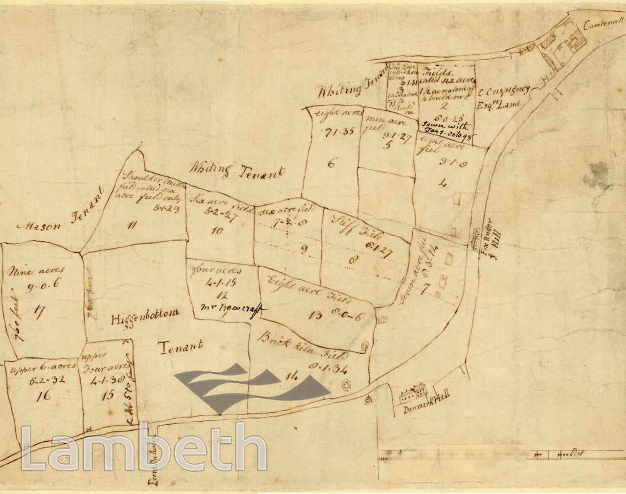
A plan of fields from Coldharbour Lane, Camberwell across to Herne Hill. The names include: Brick Kiln Field, Stiff Field and Shoulder Mutton Field. Tenants mentioned are: Mr Mason, Mr Whiting and Mr Higgenbottom; plus owners: Robert Bulkelly Esq., and C Crispigney Esq.
Buy a High Resolution Version of this Image to Print at Home for £18.00
You can use the button below to buy a high resolution version of this image to print at home.
This image is supplied for private use or study. If you wish to publish the image in any medium, please complete and return the copyright declaration, telling us about your intended use. Please return the completed form to archives@lambeth.gov.uk.
Download commercial reproduction application form here.
| Details | |
|---|---|
| Collection: | |
| Image type: | Drawing |
| Artist: | |
| Ref: | 11209 |
| Identifier: | 12/c.1783/MF |
| Date: | c.1783 |
#-Before 1850 #Drawing #OPEN SPACES #ROADS AND STREETS