Single Image Page
CARY’S SURVEY OF THE HIGHROADS, LONDON TO EAST GRINSTEAD
CARY’S SURVEY OF THE HIGHROADS, LONDON TO EAST GRINSTEAD
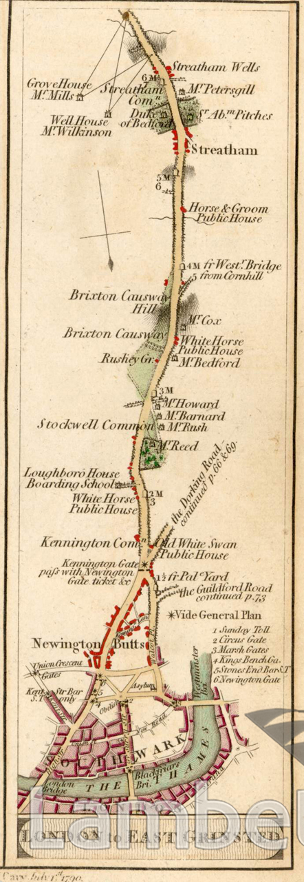
London to East Grinstead Road, from The Thames at Southwark to Streatham Wells. Map from 'Cary's Survey of the High Roads from London' printed for J.Cary, Engraver & Map seller, July 1st 1790.
Buy a High Resolution Version of this Image to Print at Home for £18.00
You can use the button below to buy a high resolution version of this image to print at home.
This image is supplied for private use or study. If you wish to publish the image in any medium, please complete and return the copyright declaration, telling us about your intended use. Please return the completed form to archives@lambeth.gov.uk.
Download commercial reproduction application form here.
| Details | |
|---|---|
| Collection: | LAD Cuttings and Ephemera |
| Image type: | Engraving |
| Artist: | |
| Ref: | 01708 |
| Identifier: | 1/1790/M159/p.62 |
| Date: | 1790 |
#-Before 1850 #Cuttings and Ephemera #Engraving #OPEN SPACES #ROADS AND STREETS
No location data for this post.