Single Image Page
EDWARDS’ MAP, LAMBETH
EDWARDS’ MAP, LAMBETH
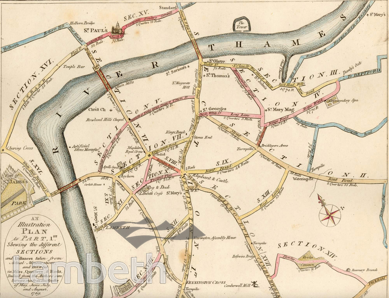
Road map from Edwards's Companion from London to Brighthelmston, surveyed in 1789.
Digital download not available
This image is unavailable for immediate download. This will normally be because we do not hold the full rights to it or because there are issues we need to check with you before supplying it.
Please contact archives@lambeth.gov.uk for further clarification.
Download commercial reproduction application form here.
| Details | |
|---|---|
| Collection: | Local History Library |
| Image type: | Engraving |
| Artist: | |
| Ref: | 01867 |
| Identifier: | LHLib/S2079 |
| Date: | 1801 |
#-Before 1850 #Engraving #Local History Library #OPEN SPACES #RIVERS AND WATERCOURSES #ROADS AND STREETS
No location data for this post.