Single Image Page
LOUGHBOROUGH PARK, LOUGHBOROUGH JUNCTION
LOUGHBOROUGH PARK, LOUGHBOROUGH JUNCTION
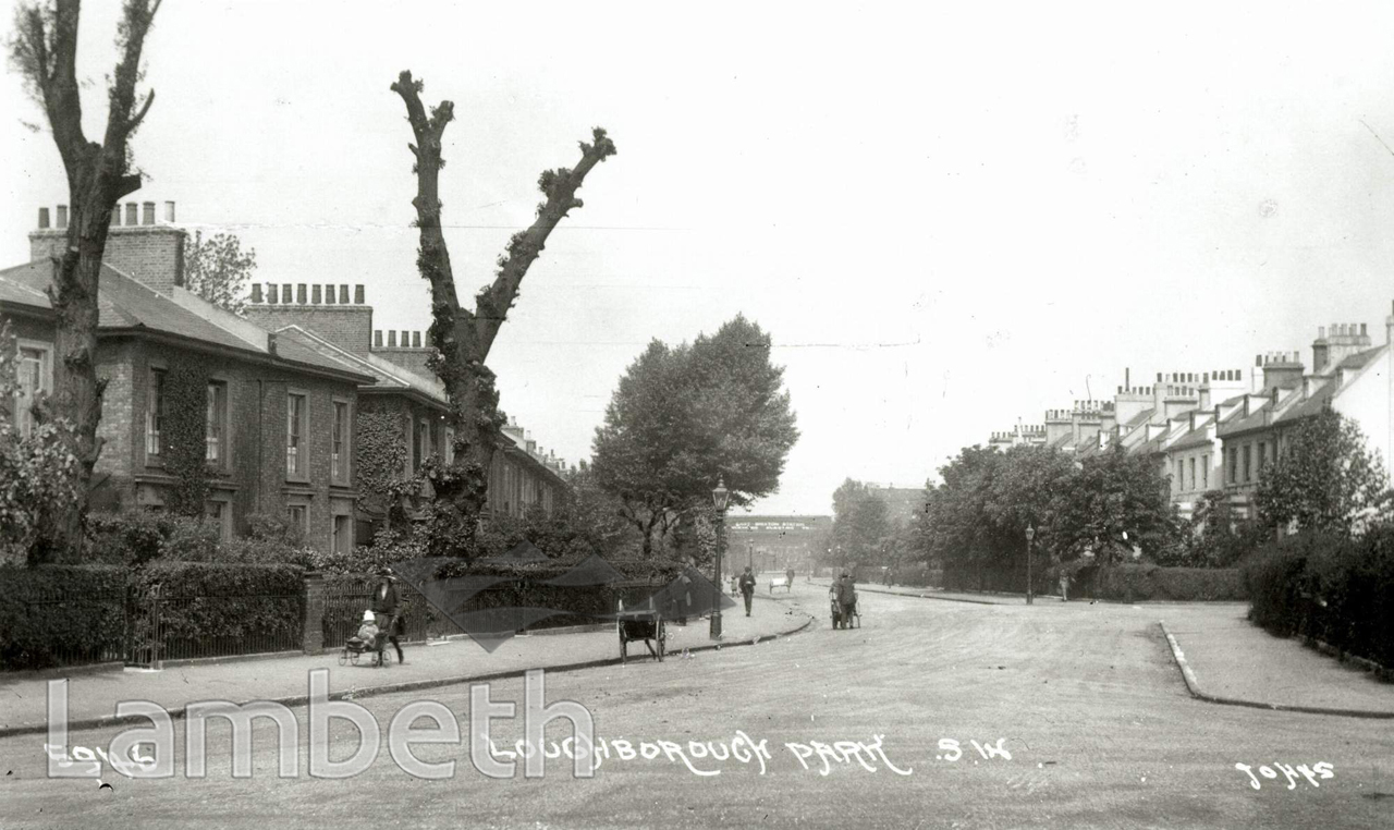
Loughborough Park was originally a Y-shaped road, the branch facing in this view was renamed Moorland Road in the 1970s. The large semi-detached houses on the right have survived but all the houses on the opposite side of Moorland Road have been demolished and replaced by council housing, with the Southwyck House at the end of the road where it joins Coldharbour Lane. The railway bridge in the background is labelled 'East Brixton Station', which was originally Loughborough Park and closed in 1976.
Buy a High Resolution Version of this Image to Print at Home for £18.00
You can use the button below to buy a high resolution version of this image to print at home.
This image is supplied for private use or study. If you wish to publish the image in any medium, please complete and return the copyright declaration, telling us about your intended use. Please return the completed form to archives@lambeth.gov.uk.
Download commercial reproduction application form here.
| Details | |
|---|---|
| Collection: | |
| Image type: | Photograph |
| Artist: | Johns |
| Ref: | 04948 |
| Identifier: | SUB/LAM/00513 |
| Date: | c.1921 |
#1876 - 1900 #ARCHITECTURE / BUILDINGS #HOUSING #LOUGHBOROUGH JUNCTION #Photograph #TRANSPORT