Single Image Page
LAURIE’S PLAN OF LONDON: VAUXHALL AND KENNINGTON
LAURIE’S PLAN OF LONDON: VAUXHALL AND KENNINGTON
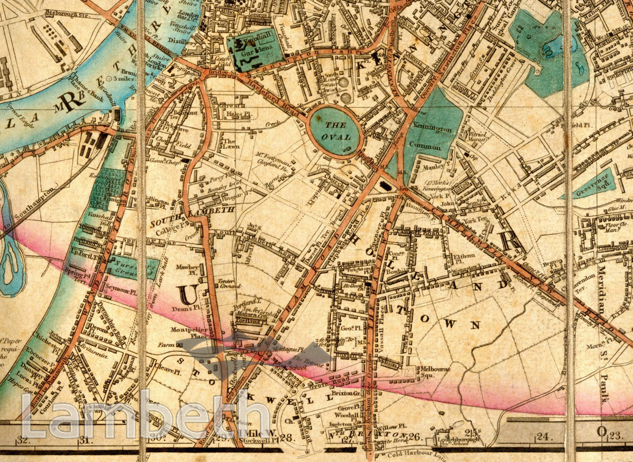
Map showing Vauxhall, Kennington and North Brixton. By 1844 we see more residential and developed areas along the main roads and near the river. Vauxhall Pleasure Gardens, formerly the most popular place of entertainment south of the river, was now facing competition from the Crystal Palace; the Oval lies to its east (shortly before it was leased to the Surrey Cricket Club in 1845); and Kennington Common nearby, shown here before it became Kennington Park, with the Horns Public House and the Kennington turnpike on its left. There are still fields and farms to the south, very soon to be replaced by networks of streets and housing estates, as trains and trams improve the public transport links. Extract from Laurie's Plan of London, Westminster and Southwark, surveyed by John Outhett and published by Richard Holmes Laurie, 1844
Buy a High Resolution Version of this Image to Print at Home for £14.40
You can use the button below to buy a high resolution version of this image to print at home.
This image is supplied for private use or study. If you wish to publish the image in any medium, please complete and return the copyright declaration, telling us about your intended use. Please return the completed form to archives@lambeth.gov.uk.
Download commercial reproduction application form here.
| Details | |
|---|---|
| Collection: | |
| Image type: | |
| Artist: | |
| Ref: | 04989 |
| Identifier: | SUB/LAM/01283 |
| Date: | 1844 |
#-Before 1850 #ENTERTAINMENT #OPEN SPACES #Print #PUBLIC HOUSES & INNS #RECREATION AND LEISURE #RIVERS AND WATERCOURSES #ROADS AND STREETS #SPORT