Single Image Page
LAURIE’S PLAN OF LONDON: LAMBETH NORTH AND WATERLOO
LAURIE’S PLAN OF LONDON: LAMBETH NORTH AND WATERLOO
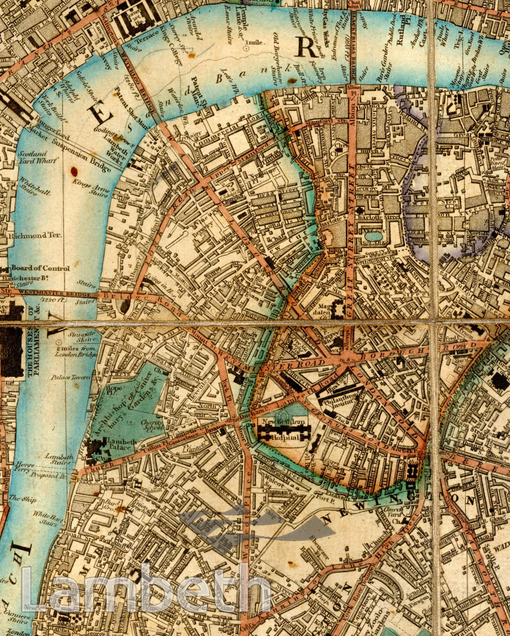
Map showing Waterloo and Lambeth North. By 1844 we see more residential and developed areas in the northern half of Lambeth, particularly along the main roads and near the river. River traffic is still the popular mode of transport, as can be seen from the many riverside stairs, such as Lambeth Stairs, seen next to the large garden of Lambeth Palace. Bishops Walk to its left along the river was to be the site of St Thomas's Hospital in 1869, and Lambeth Suspension Bridge replaced Lambeth Stairs and the horse ferry in 1862. Extract from Laurie's Plan of London, Westminster and Southwark, surveyed by John Outhett and published by Richard Holmes Laurie, 1844.
Buy a High Resolution Version of this Image to Print at Home for £12.00
You can use the button below to buy a high resolution version of this image to print at home.
This image is supplied for private use or study. If you wish to publish the image in any medium, please complete and return the copyright declaration, telling us about your intended use. Please return the completed form to archives@lambeth.gov.uk.
Download commercial reproduction application form here.
| Details | |
|---|---|
| Collection: | |
| Image type: | |
| Artist: | |
| Ref: | 04990 |
| Identifier: | 2/1844/M56 |
| Date: | 1844 |
#-Before 1850 #ARCHITECTURE / BUILDINGS #Print #RELIGION #RIVERS AND WATERCOURSES #ROADS AND STREETS