Single Image Page
NORTH AND SOUTH MARSH WARDS, PLAN OF THE PARISH OF LAMBETH
NORTH AND SOUTH MARSH WARDS, PLAN OF THE PARISH OF LAMBETH
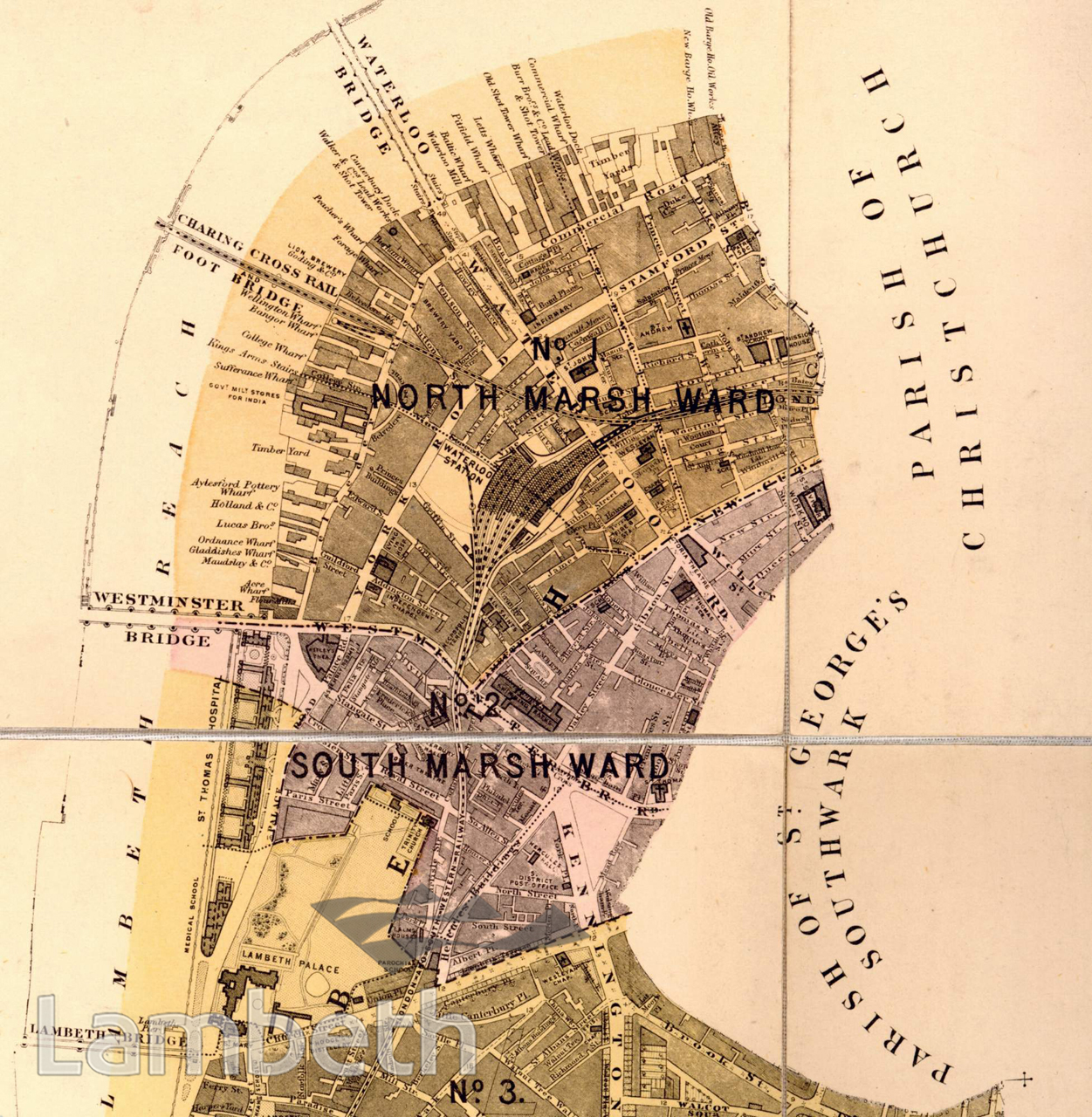
The North and South Marsh wards show the huge changes further inland from the river following the impact of the railways on South London. Waterloo Station is already the focal point of lines going south, east and across the river via the Charing Cross (Hungerford) railway bridge, which was built in 1864. The many docks and wharfs on the river bank bear witness to the huge import and export industry as well as the existing pottery, timber, lead shot and other local Lambeth industries that in 1876 still used the river as their main mode of transportation. Near the foot of Westminster Bridge is the recently constructed St Thomas's Hospital, built in 1869-1871, which replaced Bishops Walk. Lying to it's south is Lambeth Palace, the home of the Archbishop of Canterbury. Extract from the 'Plan of The Parish of Lambeth, showing its Divisions into Wards and Ecclesiastical Districts', surveyor Hugh McIntosh, 1876.
Buy a High Resolution Version of this Image to Print at Home for £18.00
You can use the button below to buy a high resolution version of this image to print at home.
This image is supplied for private use or study. If you wish to publish the image in any medium, please complete and return the copyright declaration, telling us about your intended use. Please return the completed form to archives@lambeth.gov.uk.
Download commercial reproduction application form here.
| Details | |
|---|---|
| Collection: | |
| Image type: | |
| Artist: | |
| Ref: | 04992 |
| Identifier: | SUB/LAM/01286 |
| Date: | 1876 |
#1876 - 1900 #HEALTH #Print #RELIGION #RIVERS AND WATERCOURSES #ROADS AND STREETS #TRANSPORT