Single Image Page
VAUXHALL WARD, PLAN OF THE PARISH OF LAMBETH
VAUXHALL WARD, PLAN OF THE PARISH OF LAMBETH
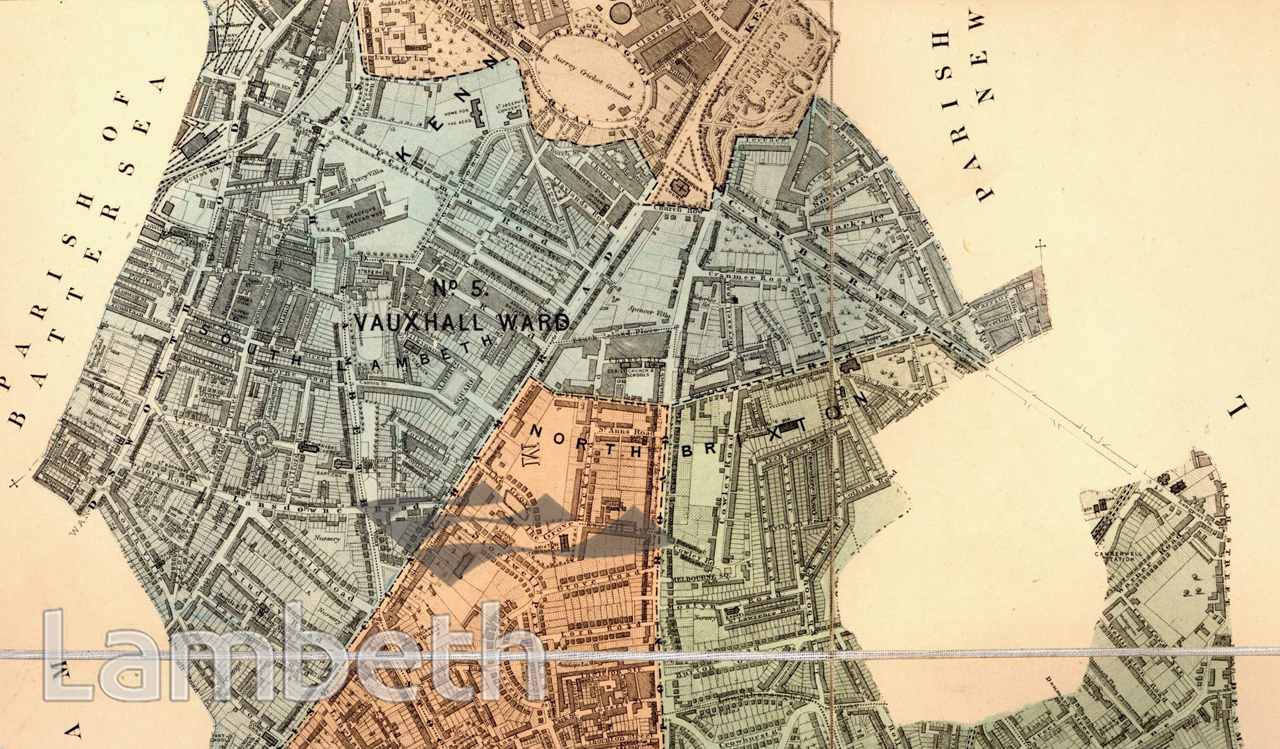
Vauxhall ward and part of Stockwell and North Brixton wards seen here reflect the changes in the area from the beginning of the 1800s, specifically the opening of the Vauxhall Bridge in 1816. Few fields remain owing to the growing trend of terraced and semi-detached housing, bearing witness to the demand for affordable housing in and around London which had resulted in the subdivision of big estates and the disappearance of large mansions. However, the villa type town house is still being constructed for the growing wealthy middle class. Beaufoy's Vinegar works, visible in the top left, is one of the larger industries in the ward, manufacturing both malt-vinegar and British wines as 'Sweets'. In 1870 tram services started from the Horn's Tavern along Brixton Road to the junction with Stockwell Road. Clapham Road and Brixton Road, two important Roman thoroughfares run through this area converging at St Mark's church, Kennington. Extract from the 'Plan of The Parish of Lambeth, showing its Divisions into Wards and Ecclesiastical Districts', surveyor Hugh McIntosh, 1876.
Buy a High Resolution Version of this Image to Print at Home for £12.00
You can use the button below to buy a high resolution version of this image to print at home.
This image is supplied for private use or study. If you wish to publish the image in any medium, please complete and return the copyright declaration, telling us about your intended use. Please return the completed form to archives@lambeth.gov.uk.
Download commercial reproduction application form here.
| Details | |
|---|---|
| Collection: | |
| Image type: | |
| Artist: | |
| Ref: | 04993 |
| Identifier: | SUB/LAM/01287 |
| Date: | 1876 |
#1876 - 1900 #COMMERCE AND INDUSTRY #Print #RECREATION AND LEISURE #RELIGION #ROADS AND STREETS #SPORT #TRADE