Single Image Page
VAUXHALL AND OVAL WARDS, PARISH MAP, VAUXHALL
VAUXHALL AND OVAL WARDS, PARISH MAP, VAUXHALL
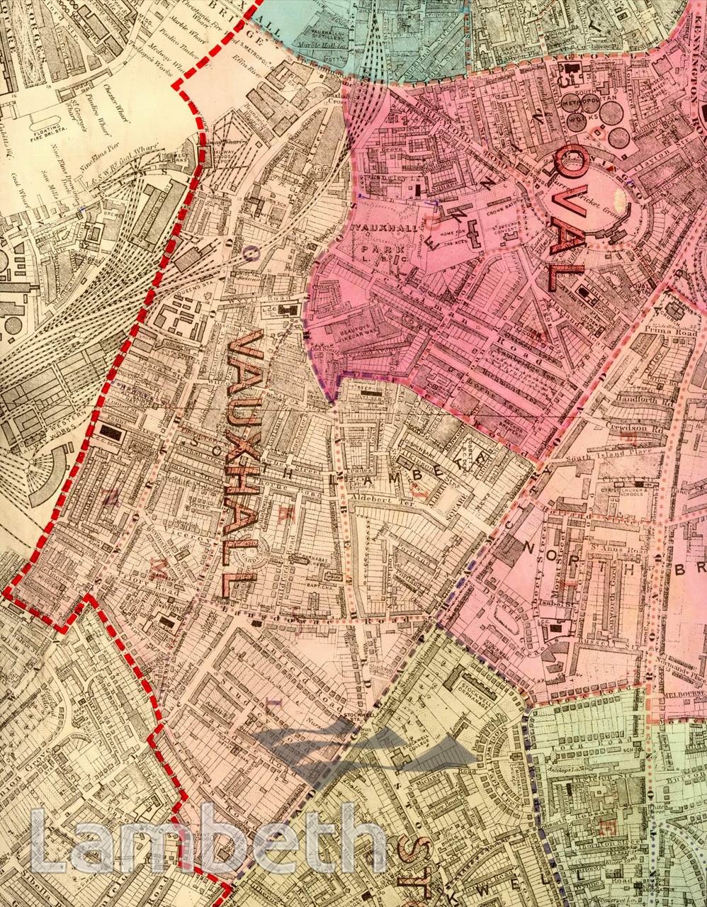
The opening of Vauxhall Bridge in 1816 had resulted in the laying out of new roads and a boom in house building. A century later most of the area had been developed, but there were great disparities in the housing types, ranging from working class cottage style terraces like those around Heman's Street in the west, to the Georgian terraces around Albert Square. The former was demolished in the 1930s and replaced by the Hemans Street estate. Industries, like Beaufoy's brewery and Vauxhall distillery, are still seen, benefiting from the improved transport system. Extracts from the map of the Metropolitan Borough of Lambeth showing the wards, parliamentary divisions and subdivisions into poling districts, 1918.
Buy a High Resolution Version of this Image to Print at Home for £14.40
You can use the button below to buy a high resolution version of this image to print at home.
This image is supplied for private use or study. If you wish to publish the image in any medium, please complete and return the copyright declaration, telling us about your intended use. Please return the completed form to archives@lambeth.gov.uk.
Download commercial reproduction application form here.
| Details | |
|---|---|
| Collection: | |
| Image type: | |
| Artist: | |
| Ref: | 05007 |
| Identifier: | SUB/LAM/01318 |
| Date: | 1918 |
#1901 - 1925 #COMMERCE AND INDUSTRY #Print #ROADS AND STREETS #TRADE