Single Image Page
LONDON AND ITS ENVIRONS, MAP OF NORTH LAMBETH
LONDON AND ITS ENVIRONS, MAP OF NORTH LAMBETH
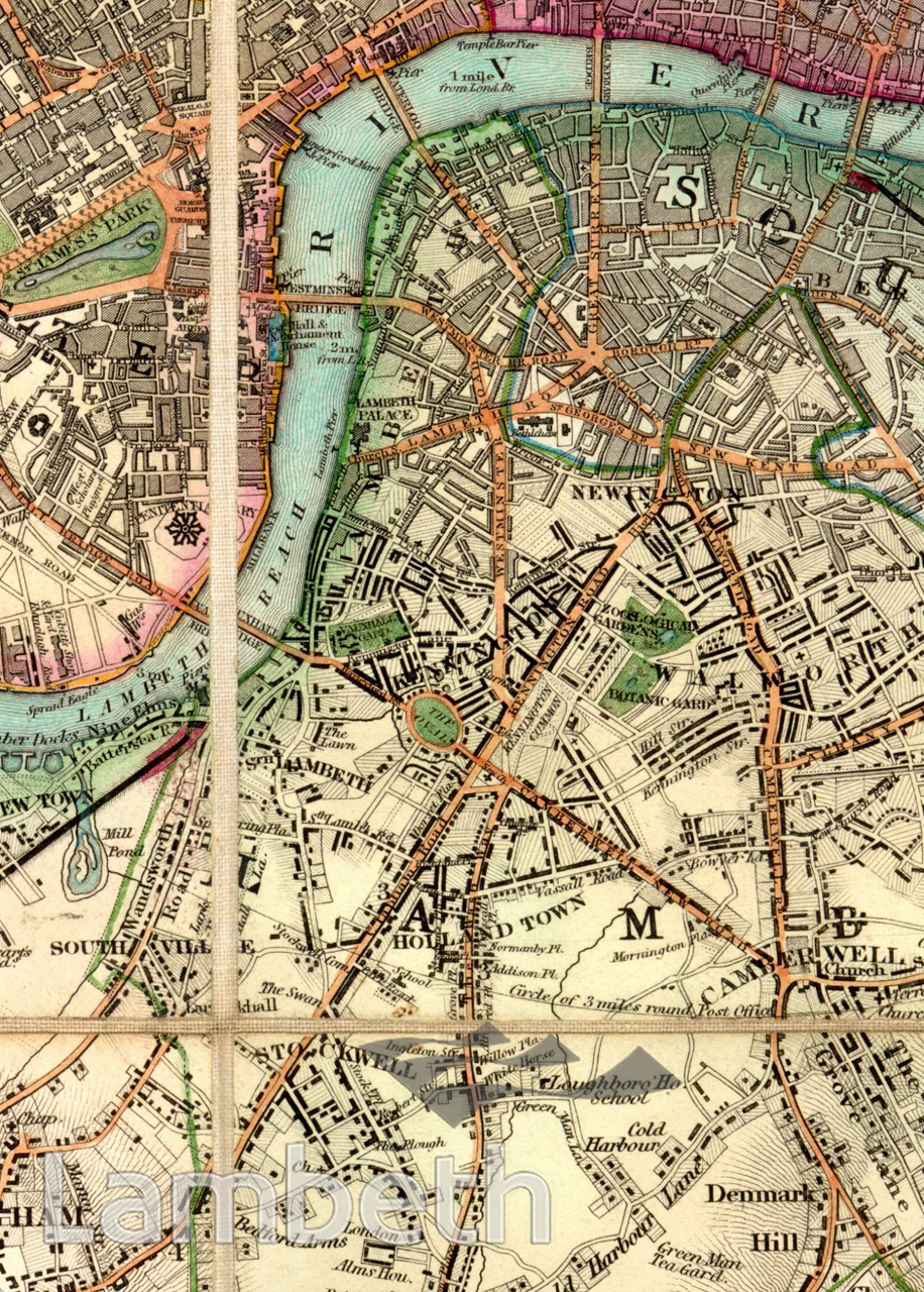
This map of the northern part of Lambeth marked inns, parks and places of interest to the public. The area adjacent to the river near the Borough High Street was the most developed with dense housing and many industries in contrast to the open land further south. North Brixton, seen at the centre, called Holland Town, was developed by Henry Vassall, 3rd Baron Holland of Foxley, commemorated by 'Holland' Grove, 'Vassall' and 'Foxley' Roads. Of note are the Zoological Gardens near the Kennington Road, which were to become the temporary home of St Thomas's Hospital in 1862, before it moved to its present position in 1871. Note also the Hungerford Pier, in 1839 plans were laid to build a suspension footbridge designed by Isambard Brunel which was completed in 1845. 'Map of London and it's Environs', published by B.R.Davies, 1840
Buy a High Resolution Version of this Image to Print at Home for £18.00
You can use the button below to buy a high resolution version of this image to print at home.
This image is supplied for private use or study. If you wish to publish the image in any medium, please complete and return the copyright declaration, telling us about your intended use. Please return the completed form to archives@lambeth.gov.uk.
Download commercial reproduction application form here.
| Details | |
|---|---|
| Collection: | |
| Image type: | |
| Artist: | |
| Ref: | 05014 |
| Identifier: | SUB/LAM/01339 |
| Date: | 1840 |
#-Before 1850 #Print #RIVERS AND WATERCOURSES #ROADS AND STREETS