Single Image Page
MARSH WARD, PARISH MAP OF LAMBETH
MARSH WARD, PARISH MAP OF LAMBETH
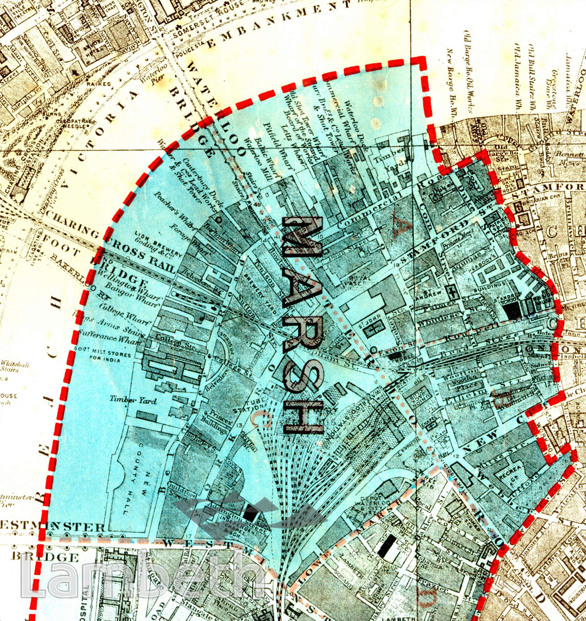
By 1918 all the main bridges across the Thames had been built and Waterloo established as a main railway junction. The docks, wharfs and industries along the riverfront still reflect the importance of the export and import industries and their dependence on river transport. The resulting social impact on the working community, a legacy from the last century, was still in the process of being addressed. Reformers like Emma Cons concentrated on improved housing and education, providing more wholesome entertainment and coffee taverns such as the Old Vic at the corner of the Cut and Waterloo Road. Extracts from the map of the Metropolitan Borough of Lambeth showing the wards, parliamentary divisions and subdivisions into polling districts, 1918.
Buy a High Resolution Version of this Image to Print at Home for £18.00
You can use the button below to buy a high resolution version of this image to print at home.
This image is supplied for private use or study. If you wish to publish the image in any medium, please complete and return the copyright declaration, telling us about your intended use. Please return the completed form to archives@lambeth.gov.uk.
Download commercial reproduction application form here.
| Details | |
|---|---|
| Collection: | |
| Image type: | |
| Artist: | |
| Ref: | 05022 |
| Identifier: | SUB/LAM/01316 |
| Date: | 1918 |
#1901 - 1925 #BRIDGES #Print #RIVERS AND WATERCOURSES #ROADS AND STREETS #TRANSPORT