Single Image Page
BISHOP’S AND PRINCE’S WARDS, PARISH MAP OF LAMBETH
BISHOP’S AND PRINCE’S WARDS, PARISH MAP OF LAMBETH
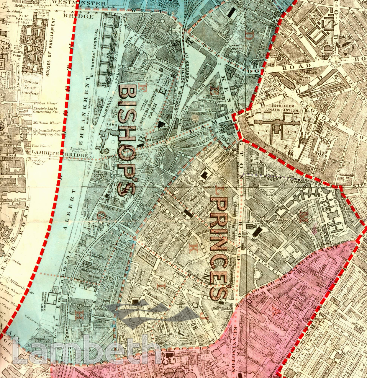
The main changes brought about by the completion of the Embankment and St Thomas's Hospital have altered the character of Bishop's Ward from the last century. The pottery industry, in 1918, is still flourishing along the riverfront, Doulton (Lambeth Pottery) being the largest. In Prince's ward the Lambeth Infirmary, originally the Workhouse and Infirmary, is prominent on the right. Changes are being undertaken by the Duchy of Cornwall to improve living conditions, such as the Royal Cottages for Working People (1904), off Kennington Road. However, terraced housing was still the most popular solution, and the proliferation of large public housing estates, had not yet begun. Extracts from the map of the Metropolitan Borough of Lambeth showing the wards, parliamentary divisions and subdivisions into poling districts, 1918.
Buy a High Resolution Version of this Image to Print at Home for £18.00
You can use the button below to buy a high resolution version of this image to print at home.
This image is supplied for private use or study. If you wish to publish the image in any medium, please complete and return the copyright declaration, telling us about your intended use. Please return the completed form to archives@lambeth.gov.uk.
Download commercial reproduction application form here.
| Details | |
|---|---|
| Collection: | |
| Image type: | |
| Artist: | |
| Ref: | 05023 |
| Identifier: | SUB/LAM/01317 |
| Date: | 1918 |
#1901 - 1925 #BRIDGES #COMMERCE AND INDUSTRY #HEALTH #Print #RELIGION #RIVERS AND WATERCOURSES #ROADS AND STREETS #TRADE