Single Image Page
BROADWALL, WATERLOO
BROADWALL, WATERLOO
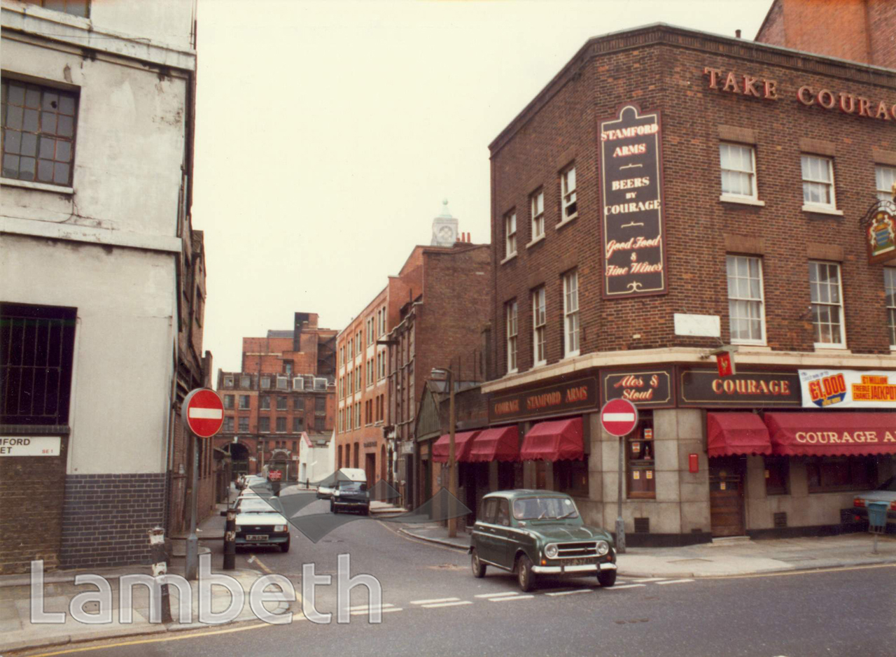
View north up Broadwall from Stamford Street. This is the parish boundary and the marker on the left denotes the eastern extent of Lambeth, with the Borough of Southwark on the right.
Buy a High Resolution Version of this Image to Print at Home for £18.00
You can use the button below to buy a high resolution version of this image to print at home.
This image is supplied for private use or study. If you wish to publish the image in any medium, please complete and return the copyright declaration, telling us about your intended use. Please return the completed form to archives@lambeth.gov.uk.
Download commercial reproduction application form here.
| Details | |
|---|---|
| Collection: | Department of Town Planning |
| Image type: | Photograph |
| Artist: | |
| Ref: | 08749 |
| Identifier: | LBL/DTP/UD2/1/12/108 |
| Date: | 1984 |
#1976 - 2000 #Department of Town Planning #FOOD AND DRINK #Photograph #STREET FURNITURE #WATERLOO