Single Image Page
‘BRIXTON HUNDRED’, EXTRACT FROM MAP OF SURREY COUNTY
‘BRIXTON HUNDRED’, EXTRACT FROM MAP OF SURREY COUNTY
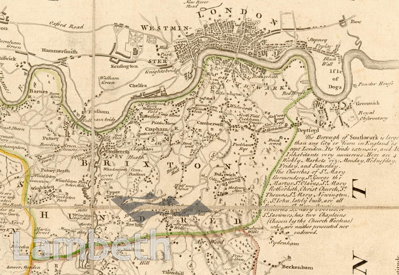
'Brixton Hundred', extract from Surrey County and Borough Towns map. A 'hundred' was an ancient administrative area. The County of Surrey was made up of 13 'Hundreds'. The meeting place for the Brixton Hundreds was on the top of Brixton Hill.Engraving of 'An Accurate Map of Surrey; divided into it's Hundreds', by Eman Bowen, c.1760.
Buy a High Resolution Version of this Image to Print at Home for £12.00
You can use the button below to buy a high resolution version of this image to print at home.
This image is supplied for private use or study. If you wish to publish the image in any medium, please complete and return the copyright declaration, telling us about your intended use. Please return the completed form to archives@lambeth.gov.uk.
Download commercial reproduction application form here.
| Details | |
|---|---|
| Collection: | |
| Image type: | Engraving |
| Artist: | |
| Ref: | 01710 |
| Identifier: | 1/c.1760/M 263 |
| Date: | c.1760 |
#-Before 1850 #Engraving #OPEN SPACES #RIVERS AND WATERCOURSES #ROADS AND STREETS
No location data for this post.