Single Image Page
CARY’S SURVEY OF LONDON SUBURBS: NORTH LAMBETH
CARY’S SURVEY OF LONDON SUBURBS: NORTH LAMBETH
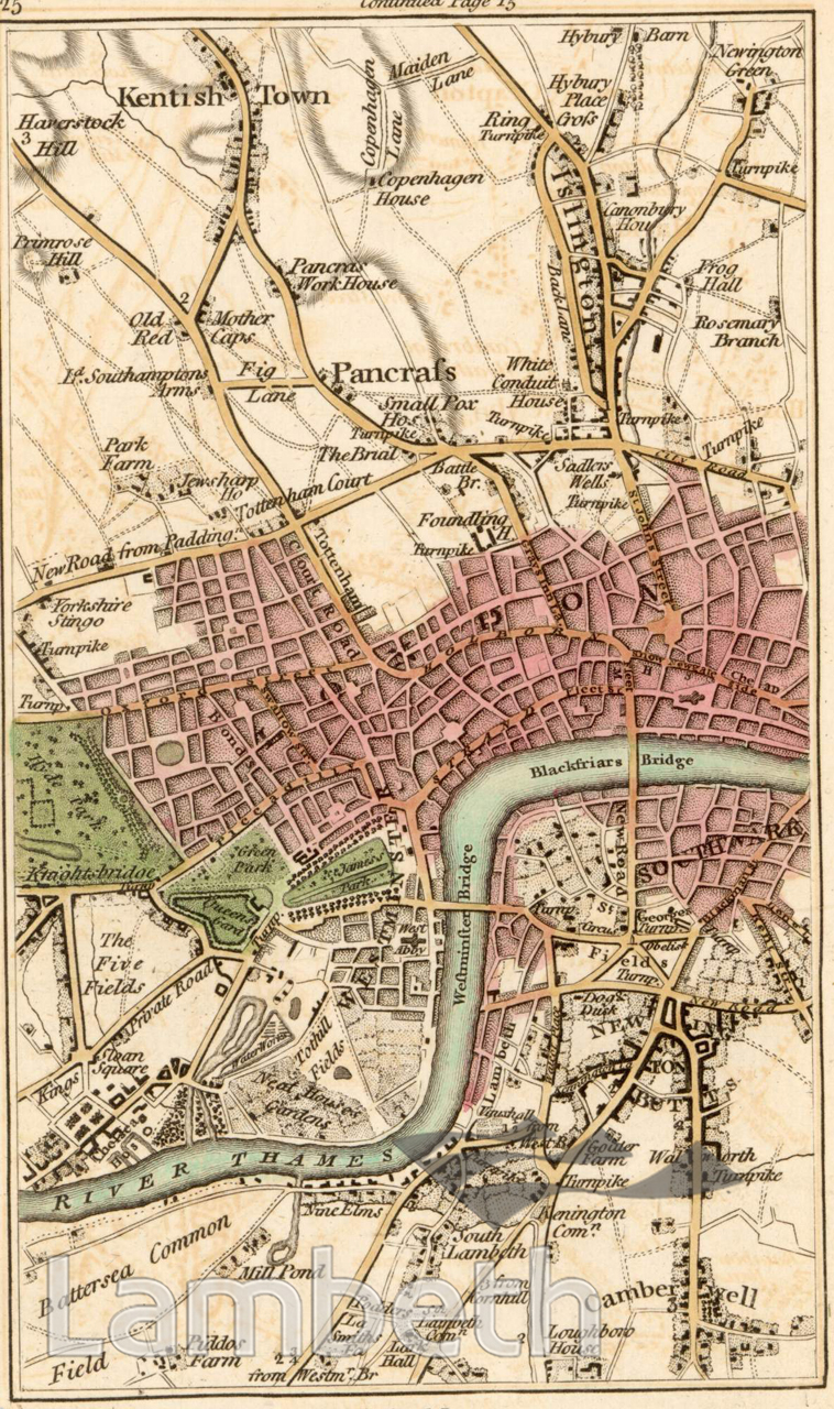
Map of the northern part of Lambeth and the surrounding area from Cary's 'Actual Survey of the Country Fifteen Miles round London'. Printed for J.Cary, engraver, Map & Print-seller, June 20th 1786.
Buy a High Resolution Version of this Image to Print at Home for £12.00
You can use the button below to buy a high resolution version of this image to print at home.
This image is supplied for private use or study. If you wish to publish the image in any medium, please complete and return the copyright declaration, telling us about your intended use. Please return the completed form to archives@lambeth.gov.uk.
Download commercial reproduction application form here.
| Details | |
|---|---|
| Collection: | LAD Cuttings and Ephemera |
| Image type: | |
| Artist: | |
| Ref: | 01706 |
| Identifier: | 1/1786/M.226/p.25 |
| Date: | 1786 |
#-Before 1850 #Cuttings and Ephemera #OPEN SPACES #Print #RIVERS AND WATERCOURSES #ROADS AND STREETS