Single Image Page
CLAPHAM AND CLAPHAM COMMON MAP
CLAPHAM AND CLAPHAM COMMON MAP
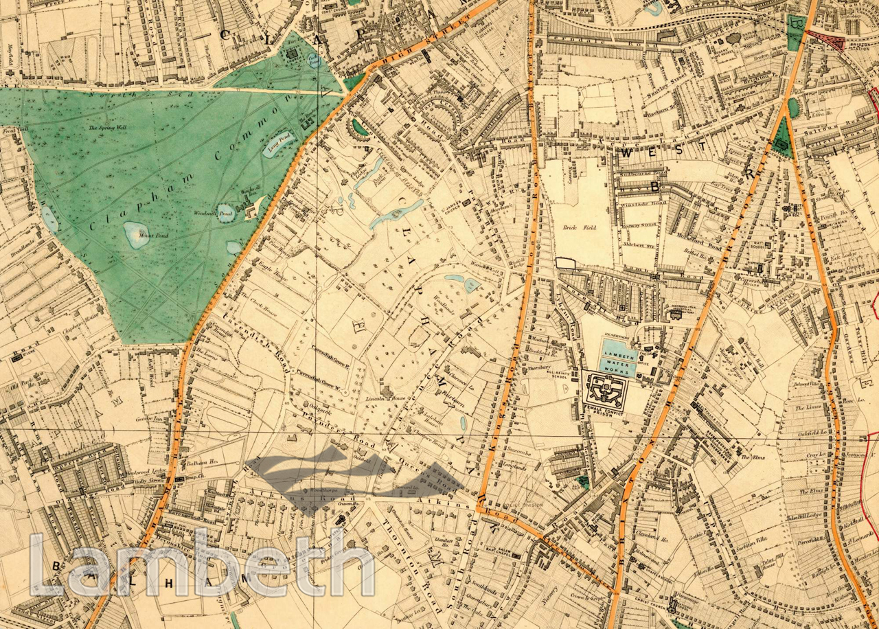
Clapham Common and Clapham Park, showing the Common on the west side. Most notable is Thomas Cubitt's Clapham Park estate, Cubitt had bought 229 acres of the Bleak Hall Farm in 1825 and had built new roads and marked out plots for large new houses. The venture was not an immediate success but by 1877, the area was one of the most important suburbs of South London. The large building marked Lincoln House was Cubitt's own family house from 1832 until 1850. Brixton Hill (road) is seen to the right of the map, along with Clapham Road it was an important Roman route into London. Brixton Prison is prominently marked at the time when it was a women's prison. Closer to the centre of Brixton is St Matthew's Church 1824, one of the four 'Waterloo' Churches built it was said, (mistakenly) to commemorate the battle victory. Just right of centre of the map the last brick field in the area can be seen. Extracts from Stanford's maps of London, 1877.
Buy a High Resolution Version of this Image to Print at Home for £18.00
You can use the button below to buy a high resolution version of this image to print at home.
This image is supplied for private use or study. If you wish to publish the image in any medium, please complete and return the copyright declaration, telling us about your intended use. Please return the completed form to archives@lambeth.gov.uk.
Download commercial reproduction application form here.
| Details | |
|---|---|
| Collection: | |
| Image type: | |
| Artist: | |
| Ref: | 05013 |
| Identifier: | SUB/LAM/01329 |
| Date: | 1877 |
#1850 - 1875 #LAW AND ORDER #OPEN SPACES #Print #RELIGION #ROADS AND STREETS