Single Image Page
CLAPHAM AND STOCKWELL MAP
CLAPHAM AND STOCKWELL MAP
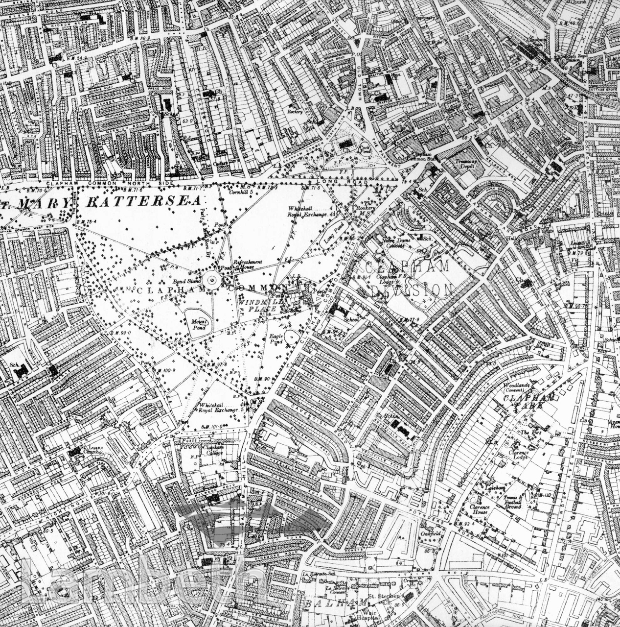
Map of Clapham, shown here almost fully populated, with ribbon development along most of the roads, reflecting a mixture of terraced and semi-detached housing. Very few large detached villas remain. The area is mainly residential, with shops lining the High Street north-east of the common. The Clapham Park estate built by the renowned builder developer Thomas Cubitt is centred around Clarence Road and King's Avenue. Post war flats were to replace many of his typical semi-detached houses, before the trend in the late 20th century to retain and renovate desirable Victorian properties was to save the few that remained. Ordnance Survey Map 1920, N.IX Series2
Buy a High Resolution Version of this Image to Print at Home for £18.00
You can use the button below to buy a high resolution version of this image to print at home.
This image is supplied for private use or study. If you wish to publish the image in any medium, please complete and return the copyright declaration, telling us about your intended use. Please return the completed form to archives@lambeth.gov.uk.
Download commercial reproduction application form here.
| Details | |
|---|---|
| Collection: | |
| Image type: | |
| Artist: | |
| Ref: | 05009 |
| Identifier: | OS1920NM7/15 |
| Date: | 1920 |
#1901 - 1925 #HEALTH #OPEN SPACES #Print #ROADS AND STREETS