Single Image Page
CLAPHAM ROAD, KENNINGTON
CLAPHAM ROAD, KENNINGTON
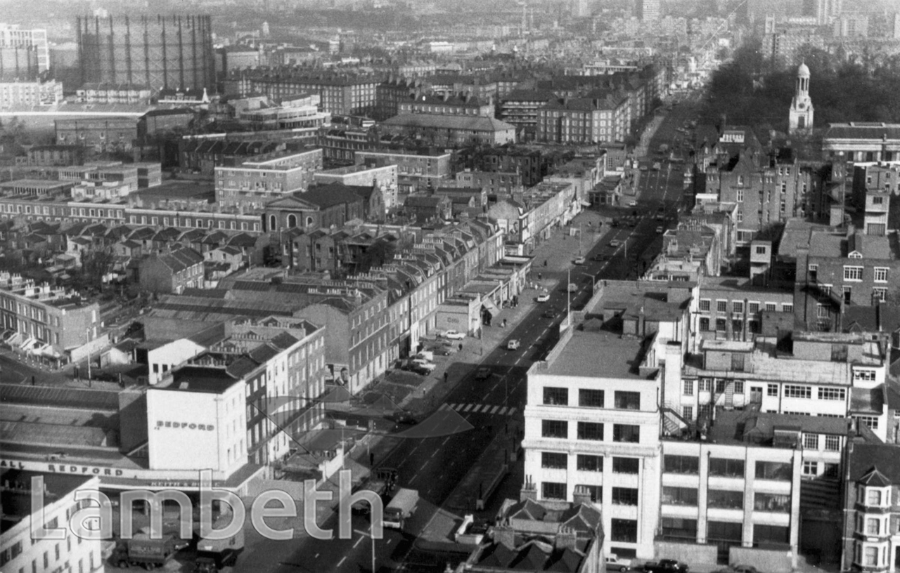
An aerial view north-east of the Clapham Road, looking towards Kennington. St Mark's spire is on the right and The Oval gas holders upper left.
Buy a High Resolution Version of this Image to Print at Home for £12.00
You can use the button below to buy a high resolution version of this image to print at home.
This image is supplied for private use or study. If you wish to publish the image in any medium, please complete and return the copyright declaration, telling us about your intended use. Please return the completed form to archives@lambeth.gov.uk.
Download commercial reproduction application form here.
| Details | |
|---|---|
| Collection: | Department of Town Planning |
| Image type: | Photograph |
| Artist: | |
| Ref: | 08446 |
| Identifier: | LBL/DTP/UD/2/1/10/41 |
| Date: | c.1975 |
#1951 - 1975 #Department of Town Planning #Photograph #ROADS AND STREETS #SOUTH LAMBETH