Single Image Page
LAMBETH PARISH BOUNDARY, CAMBERWELL/ LOUGHBOROUGH JUNCTION
LAMBETH PARISH BOUNDARY, CAMBERWELL/ LOUGHBOROUGH JUNCTION
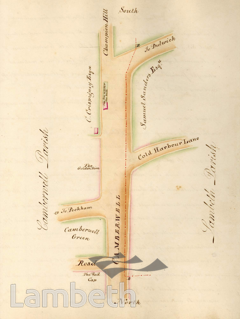
Plan showing a perambulation along the Lambeth parish boundary from Camberwell Road/ Denmark Hill to Herne Hill. Places and people noted in the accompanying text include: The Red Cap, The Golden Lion and The Fox Under the Hill public houses; C. Crispigney Esq. and Samuel Sanders Esq; Champion Hill and Coldharbour Lane.From 'Perambulation of the Parish of Lambeth in the County of Surrey, 1808' by Middleton and Bailey, Lambeth: '...the Rector, parish Officer and Inhabitants of Lambeth, have, from time immemorial, been in the habit of walking the Bounds of the Parish.'
Buy a High Resolution Version of this Image to Print at Home for £12.00
You can use the button below to buy a high resolution version of this image to print at home.
This image is supplied for private use or study. If you wish to publish the image in any medium, please complete and return the copyright declaration, telling us about your intended use. Please return the completed form to archives@lambeth.gov.uk.
Download commercial reproduction application form here.
| Details | |
|---|---|
| Collection: | Local History Library |
| Image type: | Woodcut |
| Artist: | Bailey Middleton |
| Ref: | 01605 |
| Identifier: | P6 / p33 |
| Date: | 1808 |
#-Before 1850 #Local History Library #LOUGHBOROUGH JUNCTION #OPEN SPACES #PUBLIC HOUSES & INNS #ROADS AND STREETS #STREET FURNITURE #Woodcut