Single Image Page
LONDON TO CROYDON ROAD MAP
LONDON TO CROYDON ROAD MAP
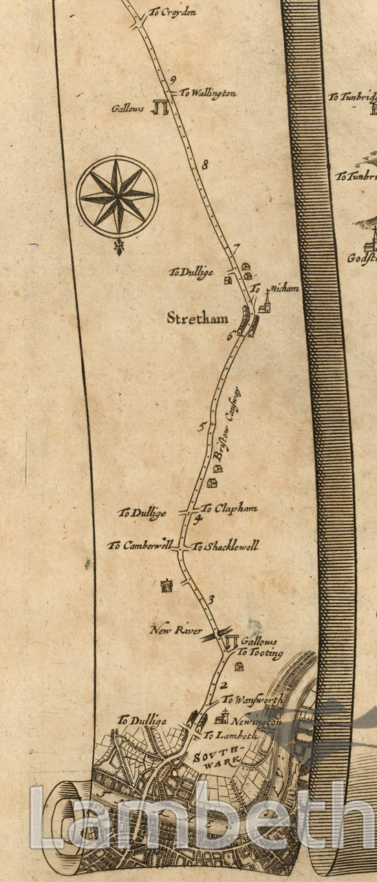
A road map showing the route from central London to Croydon, also visible are the gallows at Kennington, 'New River' (the Effra) and 'Stretham' [Streatham] via 'Bristow Causeway' [Brixton Hill]. From Ogilby's 'Britannia', published in 1675.
Buy a High Resolution Version of this Image to Print at Home for £18.00
You can use the button below to buy a high resolution version of this image to print at home.
This image is supplied for private use or study. If you wish to publish the image in any medium, please complete and return the copyright declaration, telling us about your intended use. Please return the completed form to archives@lambeth.gov.uk.
Download commercial reproduction application form here.
| Details | |
|---|---|
| Collection: | |
| Image type: | |
| Artist: | |
| Ref: | 13094 |
| Identifier: | 1/1675/MF |
| Date: | 1675 |
#-Before 1850 #LAW AND ORDER #Print #ROADS AND STREETS
No location data for this post.