Single Image Page
MANOR OF KENNINGTON, KENNINGTON : MAP
MANOR OF KENNINGTON, KENNINGTON : MAP
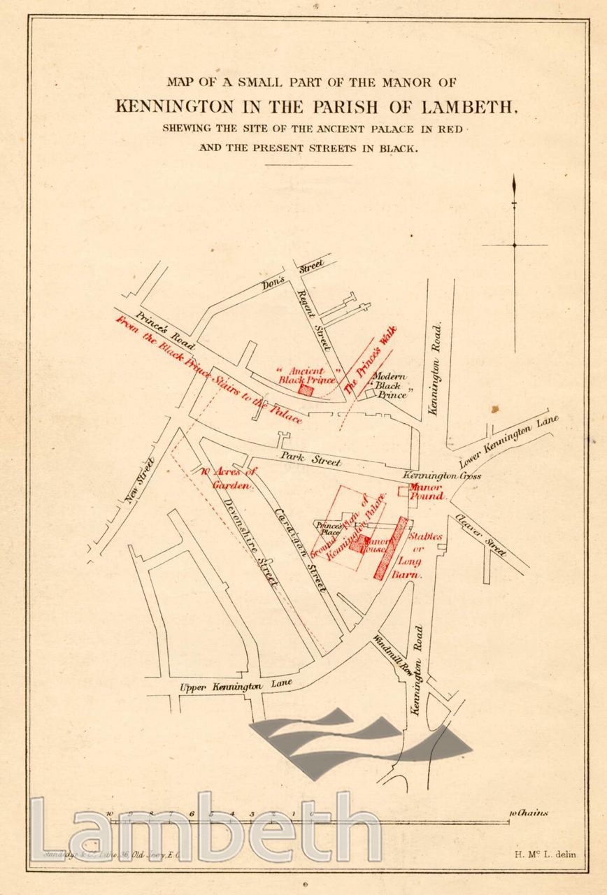
Map from 'Notes on the Site of the Palace of Kennington' by Henry MacLaughlan, F.G.C. Showing the location of the ancient Palace of Kennington including the stables or 'Long Barn', from a map made in the reign of King Charles I, 1636. Published in the Archaeological Journal, No.114, 1872.
Buy a High Resolution Version of this Image to Print at Home for £12.00
You can use the button below to buy a high resolution version of this image to print at home.
This image is supplied for private use or study. If you wish to publish the image in any medium, please complete and return the copyright declaration, telling us about your intended use. Please return the completed form to archives@lambeth.gov.uk.
Download commercial reproduction application form here.
| Details | |
|---|---|
| Collection: | LAD Cuttings and Ephemera |
| Image type: | Lithograph |
| Artist: | |
| Ref: | 01844 |
| Identifier: | Cuttings File 32 |
| Date: | 1872 |
#1850 - 1875 #ARCHITECTURE / BUILDINGS #Cuttings and Ephemera #HOUSING #KENNINGTON #Lithograph #ROADS AND STREETS