Single Image Page
MAP OF LAMBETH NORTH AND KENNINGTON
MAP OF LAMBETH NORTH AND KENNINGTON
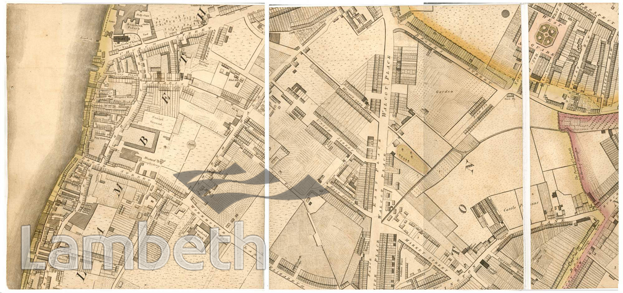
Map showing Lambeth North and north Kennington. Lambeth Palace, the London residence of the Archbishop of Canterbury and St Mary's Church, is seen on the top left corner. Most of the developed area and industries are seen along the river bank, the Thames providing the main mode of transport. Further inland few residential roads run through the farmland and wooded areas, and housing is mainly concentrated along Walcot Place, which follows the line of the original Roman Road to Brighton, now Kennington Road. Map published by Richard Horwood, MDCCXCIX, extract from the Middle SW Sheet, 2nd Edition.
Buy a High Resolution Version of this Image to Print at Home for £12.00
You can use the button below to buy a high resolution version of this image to print at home.
This image is supplied for private use or study. If you wish to publish the image in any medium, please complete and return the copyright declaration, telling us about your intended use. Please return the completed form to archives@lambeth.gov.uk.
Download commercial reproduction application form here.
| Details | |
|---|---|
| Collection: | |
| Image type: | |
| Artist: | |
| Ref: | 04987 |
| Identifier: | SUB/LAM/01281 |
| Date: | 1807 |
#-Before 1850 #OPEN SPACES #Print #RELIGION #RIVERS AND WATERCOURSES #ROADS AND STREETS