Single Image Page
MAP OF LAMBETH SOUTH, VAUXHALL AND KENNINGTON
MAP OF LAMBETH SOUTH, VAUXHALL AND KENNINGTON
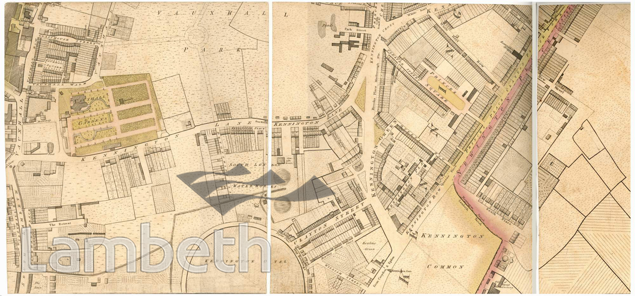
Map showing Lambeth South, Vauxhall and Kennington. Vauxhall Pleasure Gardens, seen on the left, was in its heyday, reached by boat to Vauxhall Stairs. The residential areas were concentrated along and around the main roads, particularly around Kennington Gate and Newington Place, now Kennington Park Road. Kennington Gate (turnpike) can be seen in the bottom centre of the picture, west of Kennington Common (now Park), and the Horns Tavern immediately above it. Map published by Richard Horwood, MDCCXCIX, extract from the Middle SW Sheet, 2nd Edition.
Buy a High Resolution Version of this Image to Print at Home for £12.00
You can use the button below to buy a high resolution version of this image to print at home.
This image is supplied for private use or study. If you wish to publish the image in any medium, please complete and return the copyright declaration, telling us about your intended use. Please return the completed form to archives@lambeth.gov.uk.
Download commercial reproduction application form here.
| Details | |
|---|---|
| Collection: | |
| Image type: | |
| Artist: | |
| Ref: | 04988 |
| Identifier: | 2/1807/M145 |
| Date: | 1807 |
#-Before 1850 #ENTERTAINMENT #OPEN SPACES #Print #PUBLIC HOUSES & INNS #RECREATION AND LEISURE #ROADS AND STREETS #SPORT