Single Image Page
MAP OF WATERLOO AND LAMBETH NORTH
MAP OF WATERLOO AND LAMBETH NORTH
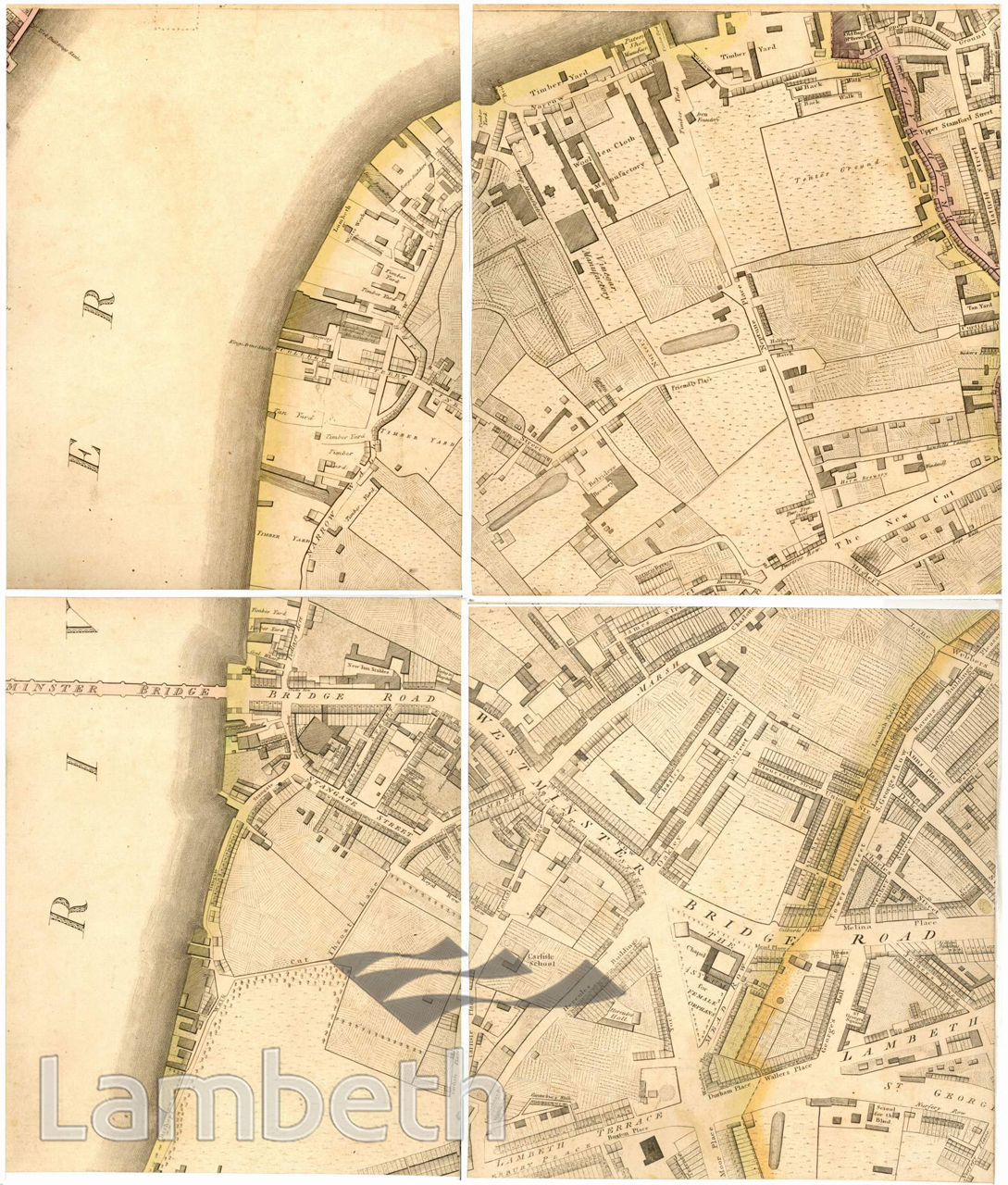
Map of Waterloo and Lambeth North, showing the various industries on or within reach of the river bank, which included timber yards, vinegar works and breweries, woollen cloth manufacture and boat building. The area inland consists mainly of farmland with few residential roads to be seen, in marked contrast to the area immediately east of it in Southwark. Astley's Amphitheatre is clearly seen just south of Westminster Bridge Road near the foot of the bridge. Map published by Richard Horwood, MDCCXCIX, extract from the Middle SW Sheet, 2nd Edition.
Buy a High Resolution Version of this Image to Print at Home for £18.00
You can use the button below to buy a high resolution version of this image to print at home.
This image is supplied for private use or study. If you wish to publish the image in any medium, please complete and return the copyright declaration, telling us about your intended use. Please return the completed form to archives@lambeth.gov.uk.
Download commercial reproduction application form here.
| Details | |
|---|---|
| Collection: | |
| Image type: | |
| Artist: | |
| Ref: | 04986 |
| Identifier: | SUB/LAM/01280 |
| Date: | 1807 |
#-Before 1850 #ENTERTAINMENT #OPEN SPACES #Print #RIVERS AND WATERCOURSES #ROADS AND STREETS