Single Image Page
NORTH LAMBETH MAP
NORTH LAMBETH MAP
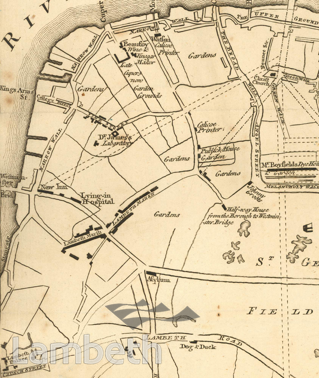
Detail from a map of the Surrey side of the Thames from Westminster Bridge to the Borough, with a plan for laying out the roads to Blackfriars Bridge. Includes: Watson calicoe printer, Beaufoy wine and vinegar maker, late Cupers now Garden Grounds, Lying-in Hospital and Dr James's laboratory.
Buy a High Resolution Version of this Image to Print at Home for £12.00
You can use the button below to buy a high resolution version of this image to print at home.
This image is supplied for private use or study. If you wish to publish the image in any medium, please complete and return the copyright declaration, telling us about your intended use. Please return the completed form to archives@lambeth.gov.uk.
Download commercial reproduction application form here.
| Details | |
|---|---|
| Collection: | |
| Image type: | |
| Artist: | |
| Ref: | 11207 |
| Identifier: | 3/1766/MF |
| Date: | 1766 |
#-Before 1850 #Print #ROADS AND STREETS
No location data for this post.