Single Image Page
NORWOOD WARD (NORTH), PLAN OF THE PARISH OF LAMBETH
NORWOOD WARD (NORTH), PLAN OF THE PARISH OF LAMBETH
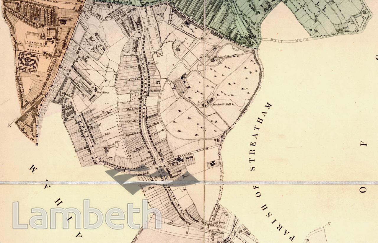
A map showing the area between Brixton Hill, Brockwell Park and Norwood Lane (now Norwood Road). Through the middle running north to south are Upper and Lower Tulse Hill, developed as parish highways in 1822. The Tulse Hill Hotel is shown at the junction of Tulse Hill and Norwood Lane. On the west side of Brixton Hill the windmill can be seen, along with the reservoir and Brixton Prison. Wealthy families began to build substantial villas with large gardens in this area from the middle of the 18th century. Brockwell Hall, built in 1813, survived as the one remaining country house in its own parkland. Extract from the 'Plan of The Parish of Lambeth, showing its Divisions into Wards and Ecclesiastical Districts', surveyor Hugh McIntosh, 1876.
Buy a High Resolution Version of this Image to Print at Home for £18.00
You can use the button below to buy a high resolution version of this image to print at home.
This image is supplied for private use or study. If you wish to publish the image in any medium, please complete and return the copyright declaration, telling us about your intended use. Please return the completed form to archives@lambeth.gov.uk.
Download commercial reproduction application form here.
| Details | |
|---|---|
| Collection: | |
| Image type: | |
| Artist: | |
| Ref: | 04997 |
| Identifier: | SUB/LAM/01291 |
| Date: | 1876 |
#1876 - 1900 #LAW AND ORDER #OPEN SPACES #Print #ROADS AND STREETS