Single Image Page
PARISH OF ST. MARY LAMBETH: MAP
PARISH OF ST. MARY LAMBETH: MAP
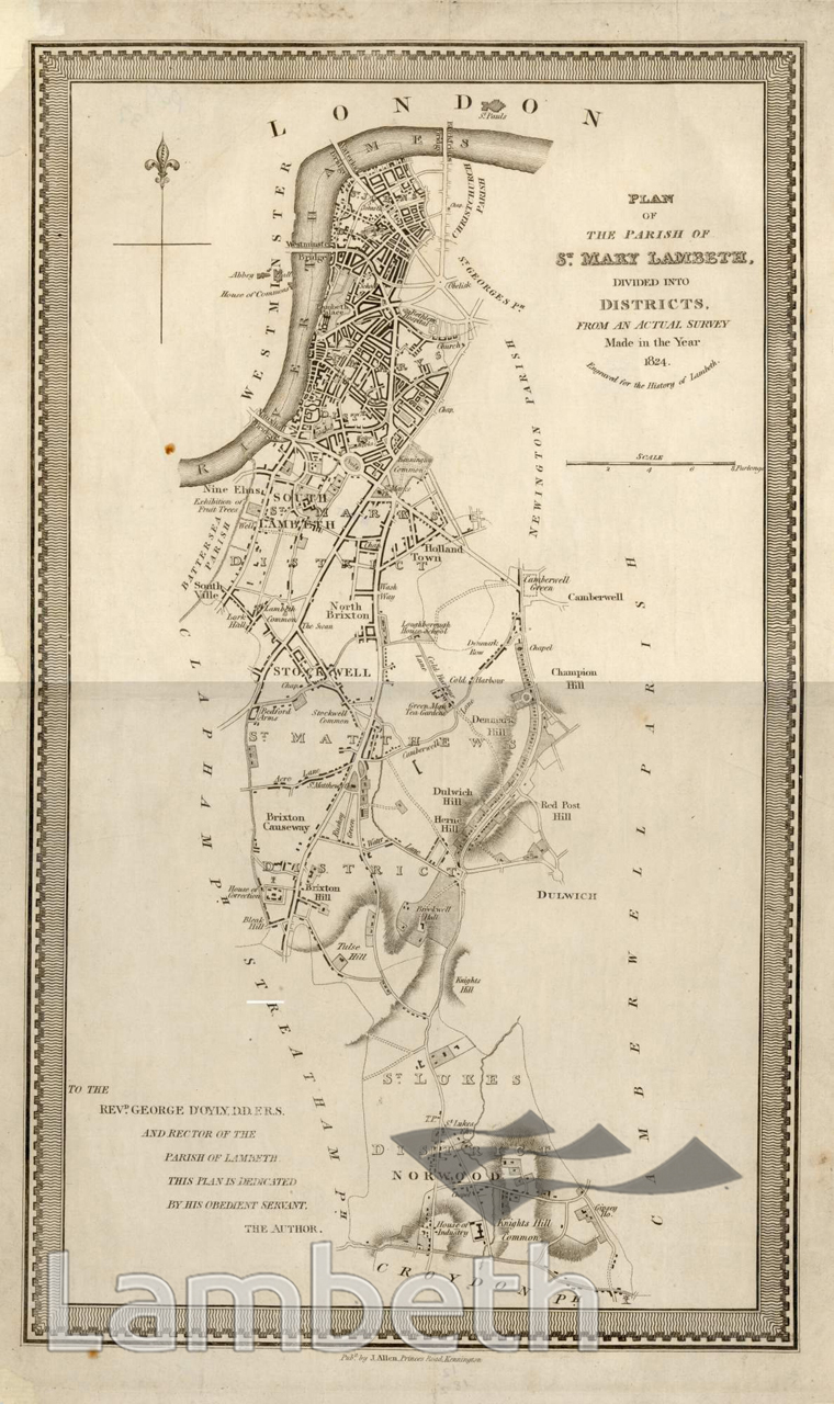
Plan of the Parish of St. Mary Lambeth from a survey made in 1824, shown here divided into five districts centred on the churches of St John's at Waterloo, St Mark's at Kennington, St Matthew's at Brixton, St Luke's at Norwood and St Mary's just outside Lambeth Palace. The map also shows Holland Town in north Brixton, named after Henry Vassal, third Baron Holland of Foxley who developed this area. Engraving published by J.Allen, Princes Road, Kennington.
Buy a High Resolution Version of this Image to Print at Home for £12.00
You can use the button below to buy a high resolution version of this image to print at home.
This image is supplied for private use or study. If you wish to publish the image in any medium, please complete and return the copyright declaration, telling us about your intended use. Please return the completed form to archives@lambeth.gov.uk.
Download commercial reproduction application form here.
| Details | |
|---|---|
| Collection: | |
| Image type: | Engraving |
| Artist: | |
| Ref: | 01894 |
| Identifier: | 12/1824/MF (B) |
| Date: | 1824 |
#-Before 1850 #Engraving #LAMBETH #OPEN SPACES #RIVERS AND WATERCOURSES #ROADS AND STREETS
No location data for this post.