Single Image Page
PARISH OF ST MATTHEW, DENMARK HILL
PARISH OF ST MATTHEW, DENMARK HILL
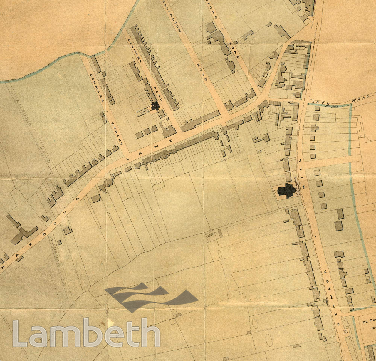
Detail from a 'Plan of the District Parish of St Matthew's, Denmark Hill in the Parish of Lambeth', from Coldharbour Lane to Denmark Hill and drawn by George Low, surveyor and architect. The church is shown along with St Matthew's school and soup kitchen in Denmark Road and the Fox under Hill public house.
Buy a High Resolution Version of this Image to Print at Home for £12.00
You can use the button below to buy a high resolution version of this image to print at home.
This image is supplied for private use or study. If you wish to publish the image in any medium, please complete and return the copyright declaration, telling us about your intended use. Please return the completed form to archives@lambeth.gov.uk.
Download commercial reproduction application form here.
| Details | |
|---|---|
| Collection: | |
| Image type: | |
| Artist: | |
| Ref: | 11225 |
| Identifier: | 12/1850/MF |
| Date: | 1850 |
#1850 - 1875 #LOUGHBOROUGH JUNCTION #Print #RELIGION #ROADS AND STREETS