Single Image Page
PROPOSED NEW ROADS AT ST GEORGES FIELDS AND NORTH LAMBETH
PROPOSED NEW ROADS AT ST GEORGES FIELDS AND NORTH LAMBETH
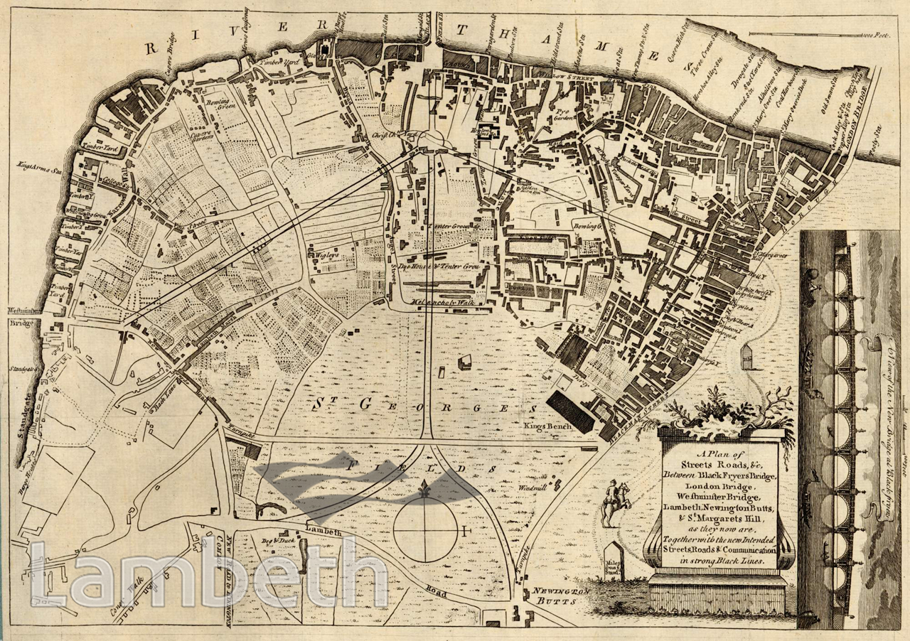
A plan of the existing roads at the north end of the Borough and the river front between Westminster and London Bridges. It also shows a new proposed road scheme under consideration at the time. The scheme was more or less constructed as planned, with only Stamford Street curving slightly northwards rather than taking the straight route shown. St George's Circus was added in the centre of St George's Fields, at the junction of five roads providing links to Lambeth Bridge and Newington Butts. The area is notable for some unusual place names such as Melancholy Walk, Dirty Lane, Bandy Leg Walk and Wigleys. In the north west corner of this area was Cupers Gardens, the famous entertainment grounds, which flourished from 1691 to 1753, accessible by river to Cuper's Bridge.
Buy a High Resolution Version of this Image to Print at Home for £12.00
You can use the button below to buy a high resolution version of this image to print at home.
This image is supplied for private use or study. If you wish to publish the image in any medium, please complete and return the copyright declaration, telling us about your intended use. Please return the completed form to archives@lambeth.gov.uk.
Download commercial reproduction application form here.
| Details | |
|---|---|
| Collection: | |
| Image type: | |
| Artist: | |
| Ref: | 04998 |
| Identifier: | 3/C 1770/MF |
| Date: | c.1770 |
#-Before 1850 #ENTERTAINMENT #OPEN SPACES #Print #RIVERS AND WATERCOURSES #ROADS AND STREETS