Single Image Page
ROCQUE MAP: STOCKWELL
ROCQUE MAP: STOCKWELL
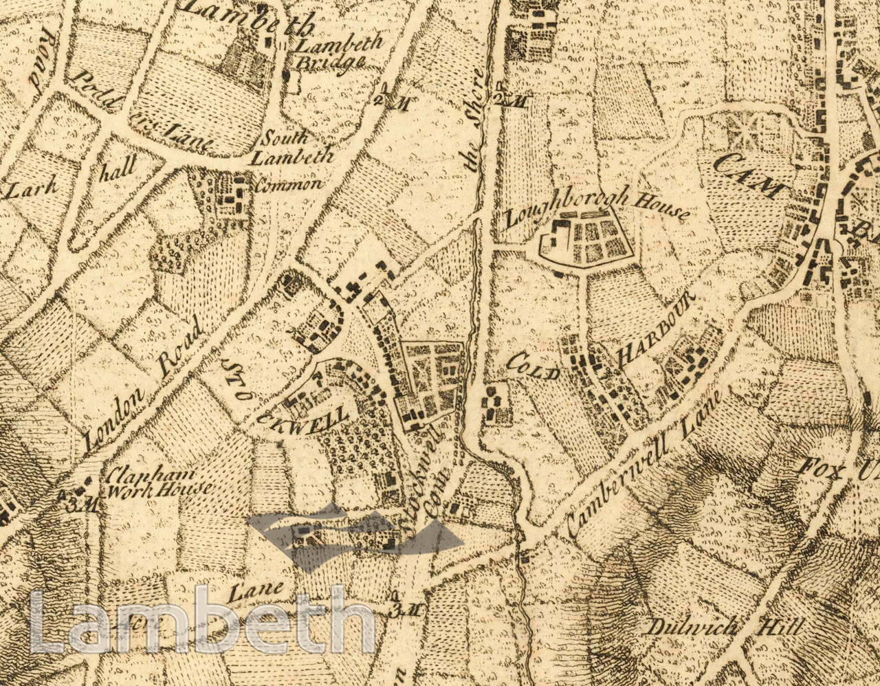
A detail from John Rocque's London maps showing Stockwell. Also shown are Stockwell Green and Stockwell Common, South Lambeth Common, Loughborough House and Camberwell Lane leading to Camberwell (later renamed Coldharbour Lane, after the adjacent settlement of Cold Harbour). Was annotated 'Mrs Jean Roques reprint, around 1760' - after Rocque died in 1762, his widow continued with the successful mapping business.From 'History and Antiquities of Camberwell' by W.H.Blanch, with additions by W.F.Noble.
Buy a High Resolution Version of this Image to Print at Home for £12.00
You can use the button below to buy a high resolution version of this image to print at home.
This image is supplied for private use or study. If you wish to publish the image in any medium, please complete and return the copyright declaration, telling us about your intended use. Please return the completed form to archives@lambeth.gov.uk.
Download commercial reproduction application form here.
| Details | |
|---|---|
| Collection: | Blanch |
| Image type: | |
| Artist: | |
| Ref: | 13174 |
| Identifier: | Blanch Vol.1 p.341 |
| Date: | c.1760 |
#-Before 1850 #Print #ROADS AND STREETS #STOCKWELL