Single Image Page
STREATHAM HIGH ROAD, STREATHAM CENTRAL : MAP OF BOMB-SITES
STREATHAM HIGH ROAD, STREATHAM CENTRAL : MAP OF BOMB-SITES
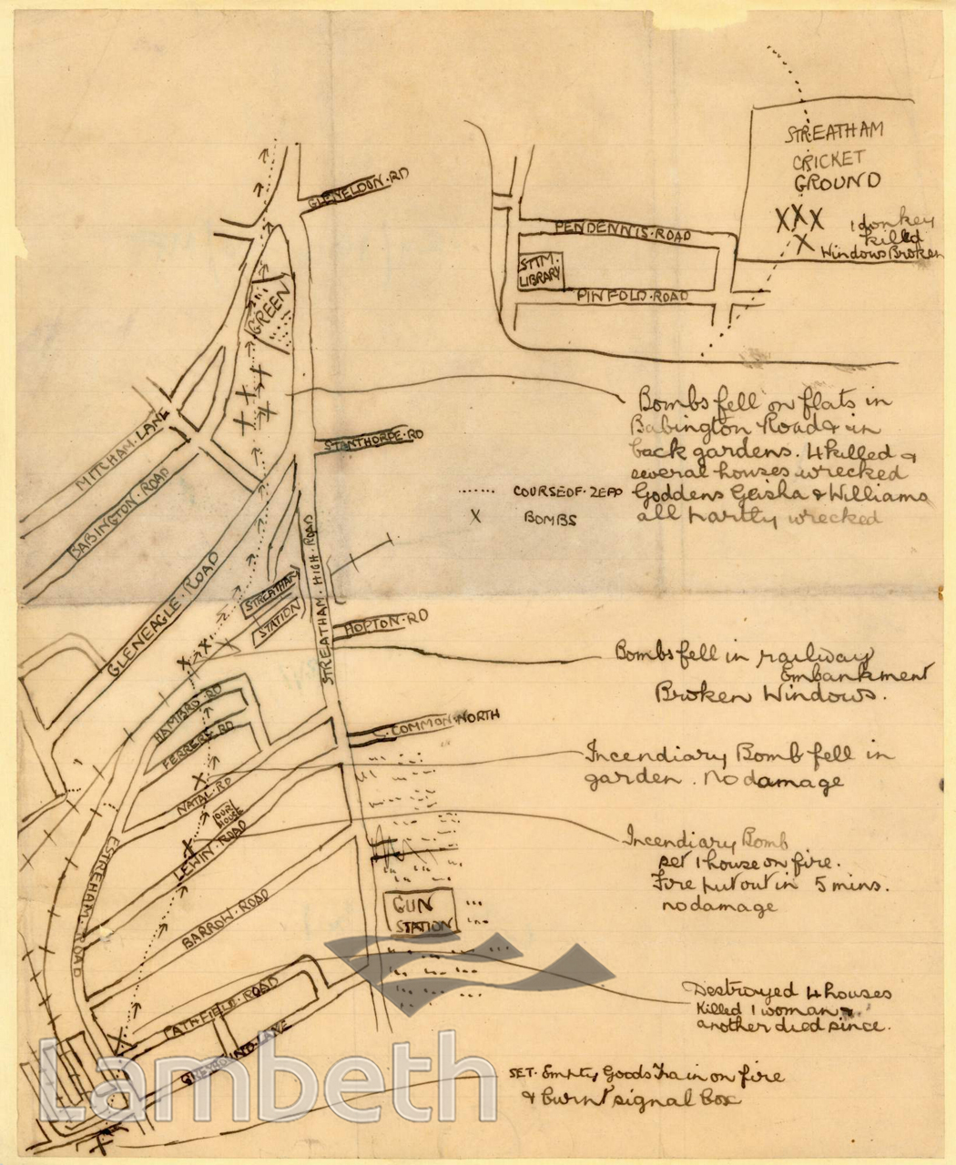
Map showing the location of bombs dropped in Streatham following the Zeppelin raid in September 1916. Inset showing the cricket ground near Pendennis Road, where a donkey was killed in a bombing incident. Hand-drawn map by unknown artist, c.1916.
Buy a High Resolution Version of this Image to Print at Home for £12.00
You can use the button below to buy a high resolution version of this image to print at home.
This image is supplied for private use or study. If you wish to publish the image in any medium, please complete and return the copyright declaration, telling us about your intended use. Please return the completed form to archives@lambeth.gov.uk.
Download commercial reproduction application form here.
| Details | |
|---|---|
| Collection: | LAD Cuttings and Ephemera |
| Image type: | Pen and Ink |
| Artist: | |
| Ref: | 01933 |
| Identifier: | 24/1914-18/MF |
| Date: | c.1916 |
#1901 - 1925 #Cuttings and Ephemera #OPEN SPACES #Pen and Ink #RECREATION AND LEISURE #ROADS AND STREETS #SPORT #STREATHAM CENTRAL #WAR AND ARMED FORCES