Single Image Page
VASSALL AND OVAL WARDS, PARISH MAP, KENNINGTON
VASSALL AND OVAL WARDS, PARISH MAP, KENNINGTON
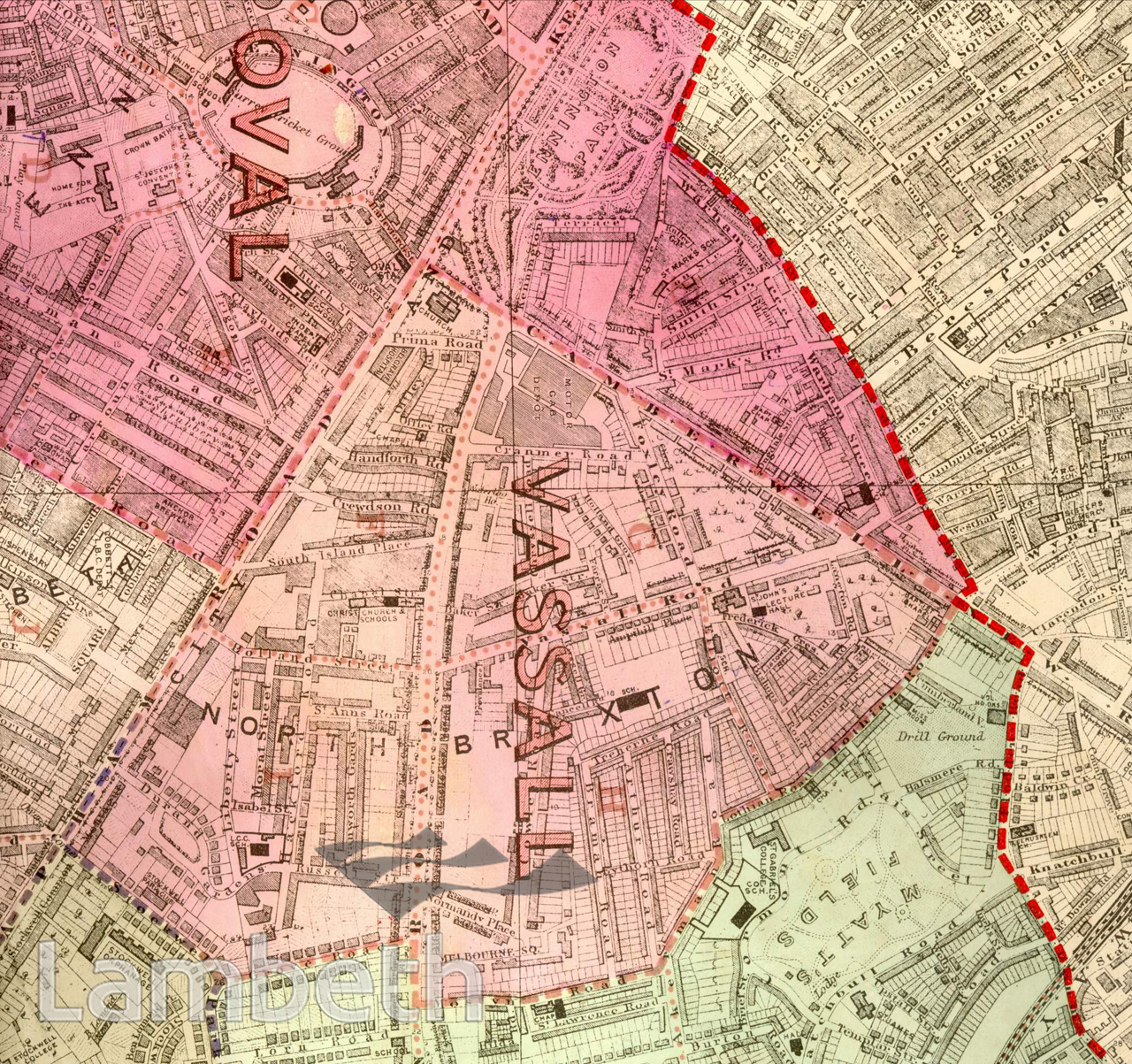
Map showing the Oval and North Brixton. The Oval is now the Surrey Cricket Ground, (leased by the Surrey Cricket Club in 1845), and Kennington Common has undergone many changes before becoming Kennington Park. St Mark's Church, just to its south, stands where the Kennington gallows used to be. Vassall Road, seen in the centre and named after Henry Vassall, 3rd Baron Holland of Foxley, was part of his development of the Lambeth Wick Estate undertaken a century earlier. It centred around Camberwell New Road and led directly to Vauxhall Bridge to the west. The development, more in the way of a garden suburb consisted of detached and semi detached Georgian villas. Myatts Fields, bottom right, was part of the estate of the Huguenot philanthropist, William Minet, who donated the park and a library to the people of Camberwell and Lambeth. Extracts from the map of the Metropolitan Borough of Lambeth showing the wards, parliamentary divisions and subdivisions into poling districts, 1918.
Buy a High Resolution Version of this Image to Print at Home for £12.00
You can use the button below to buy a high resolution version of this image to print at home.
This image is supplied for private use or study. If you wish to publish the image in any medium, please complete and return the copyright declaration, telling us about your intended use. Please return the completed form to archives@lambeth.gov.uk.
Download commercial reproduction application form here.
| Details | |
|---|---|
| Collection: | |
| Image type: | |
| Artist: | |
| Ref: | 05004 |
| Identifier: | SUB/LAM/01320 |
| Date: | 1918 |
#1901 - 1925 #OPEN SPACES #Print #RELIGION #ROADS AND STREETS