Single Image Page
VINING STREET, BRIXTON
VINING STREET, BRIXTON
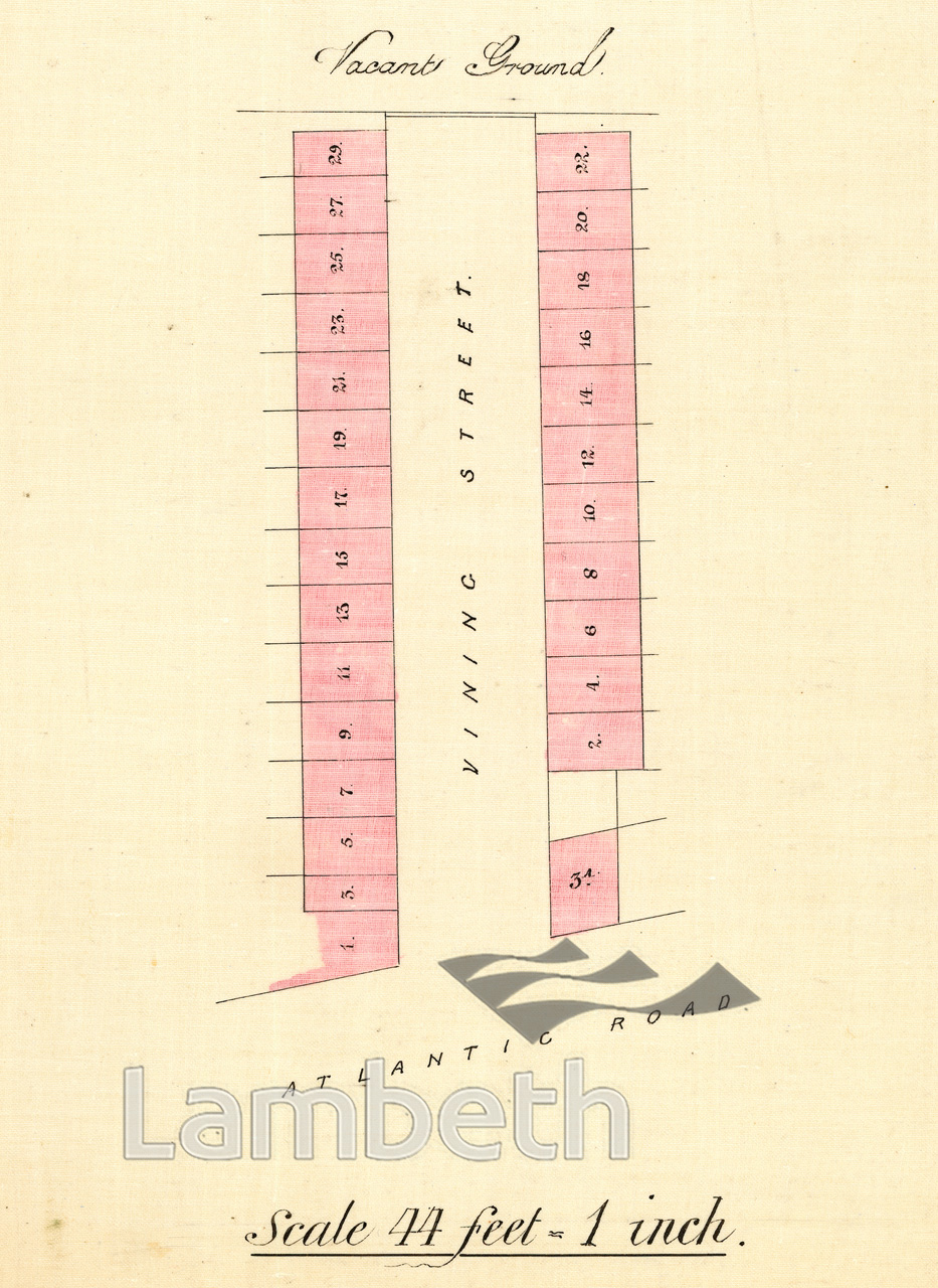
A plan showing Vining Street off Altantic Road in Brixton. Freeholder/ developer listed as mostly the F.H Standard Land & Investment Society, and E.G Chapman & Mark Lieff.
From Apportionment Files dated 1877. The files show the apportionment of costs to each owner for the construction of paths and roadways adjacent to their properties.
Buy a High Resolution Version of this Image to Print at Home for £18.00
You can use the button below to buy a high resolution version of this image to print at home.
This image is supplied for private use or study. If you wish to publish the image in any medium, please complete and return the copyright declaration, telling us about your intended use. Please return the completed form to archives@lambeth.gov.uk.
Download commercial reproduction application form here.
| Details | |
|---|---|
| Collection: | |
| Image type: | Drawing |
| Artist: | |
| Ref: | 14592 |
| Identifier: | LBL/DCEPS/SL/2/247 |
| Date: | 1877 |
#1876 - 1900 #BRIXTON #Drawing #HOUSING